 Häme
HämeHäme by Cycle: East Strider’s Trail
Forssan tori, Forssa
Forssa
Description
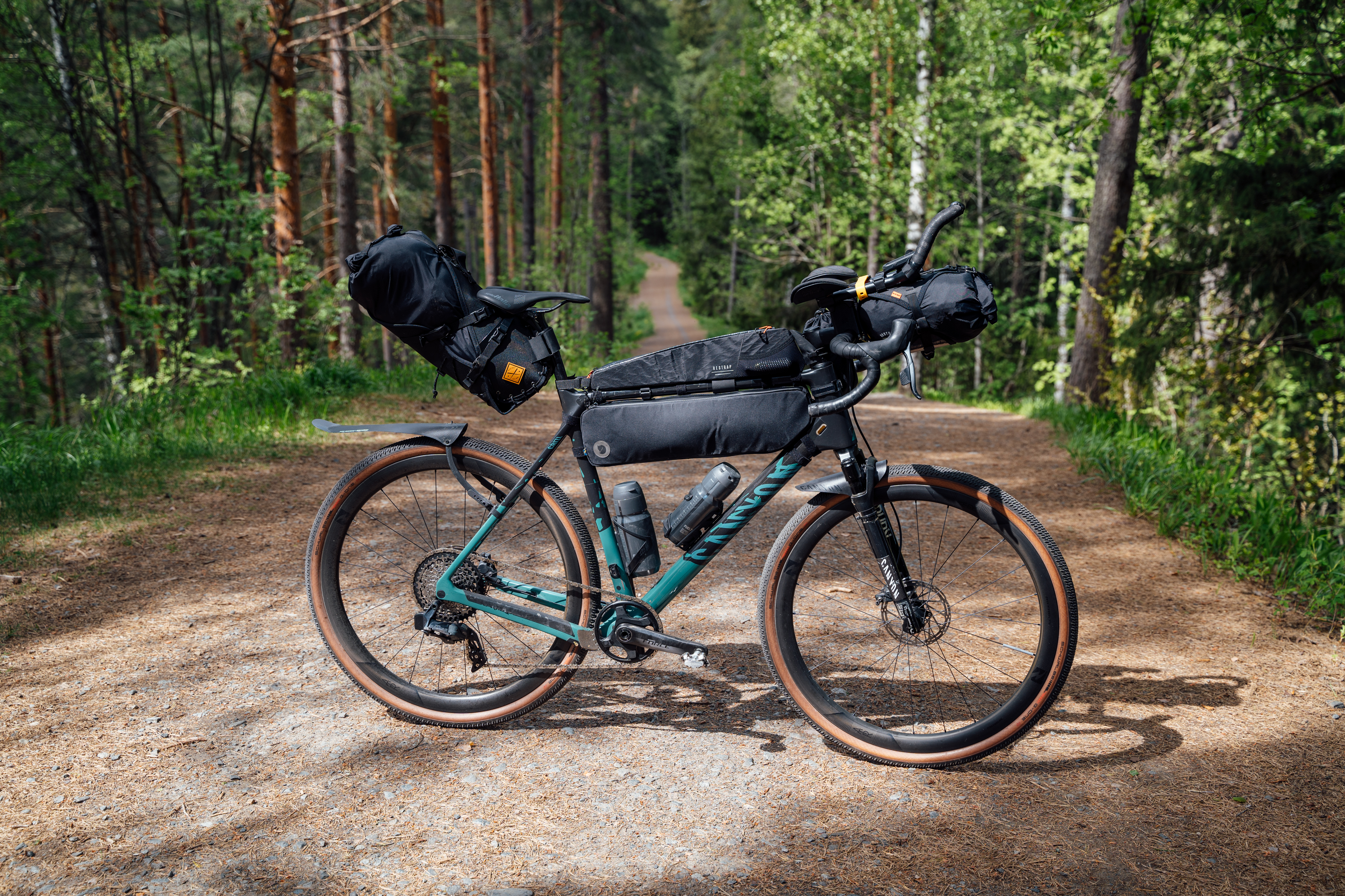
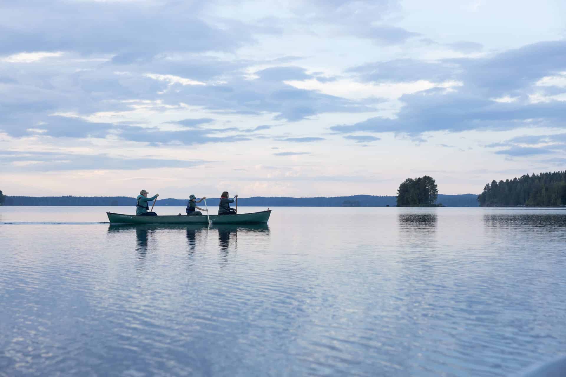
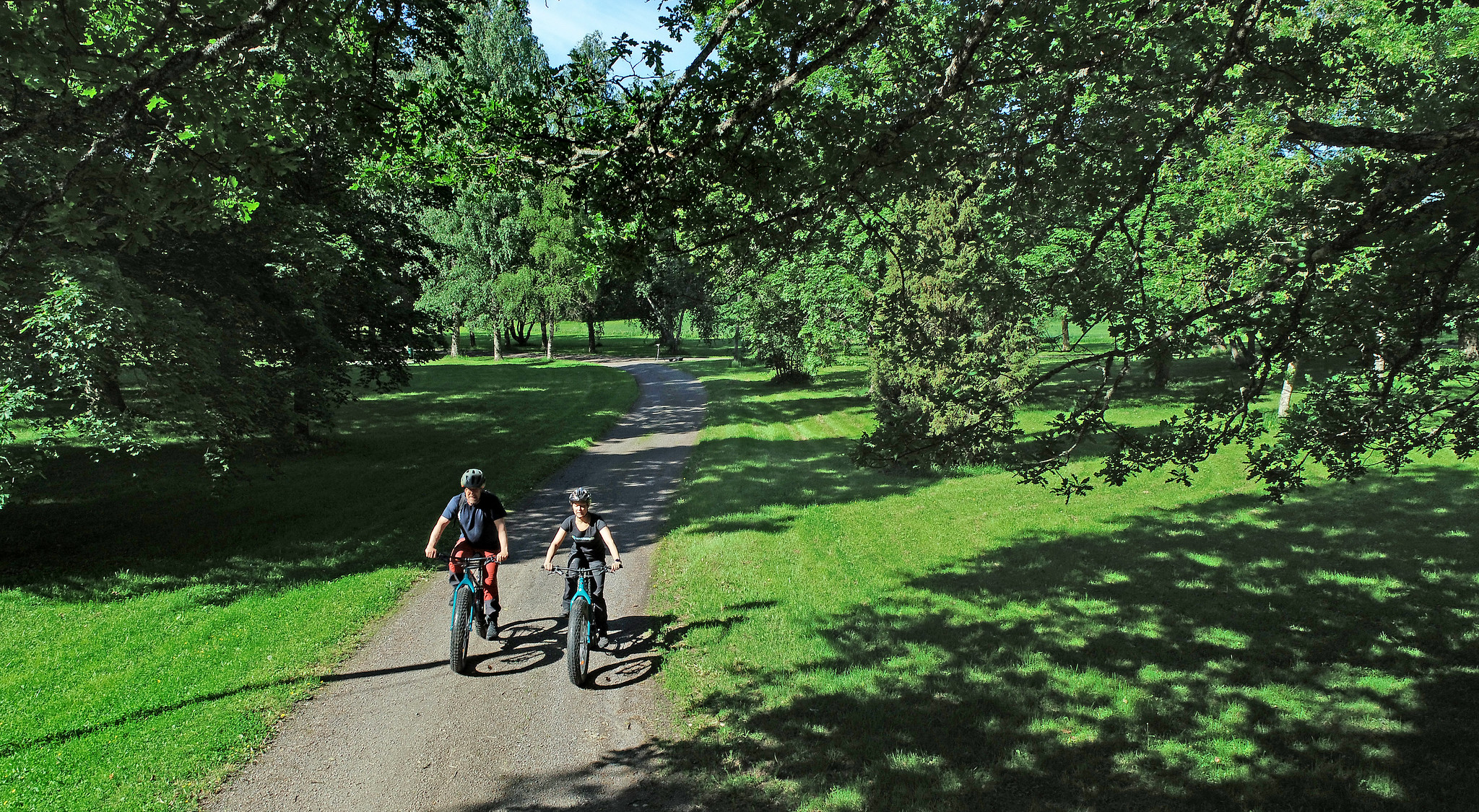
East Strider’s Trail is a 260 km long circular route that leads you through the cultural and historical landscapes, ridges, lakes, and villages of Kanta-Häme. The route combines urban services, wilderness, cultural sites, and a wide range of accommodation into a seamless cycle route especially suited for adventurers on gravel or touring bikes.
The route is designed to be completed in 3-5 days and it can be cycled both clockwise and anticlockwise. Overnighting is possible both in the middle of nature and in hotel accommodation, and services can be found at various points along the route.
The route starts at Riihimäki railway station and follows cycle paths through the city. The urban landscape soon changes to a rural idyll, and paved roads to hard gravel roads. The first rest stops are on the shores of Lake Paalijärvi and Lake Hirvijärvi, where you can take a break by the water. The route continues through the centre of Loppi to Komio Nature Reserve and the unique swamp landscape of Luutasuo.
You reach Komio Nature Reserve along a dirt road. Luutasuo’s swampy landscape and Komio’s ridges left behind by the Ice Age are the scenic highlights of the area. There are beautiful places to stop, and you can also explore the area’s varied nature on foot. The route continues through the beautiful ridge and lake landscapes of Loppi along dirt roads towards the sparse pine forests of Räyskälä.
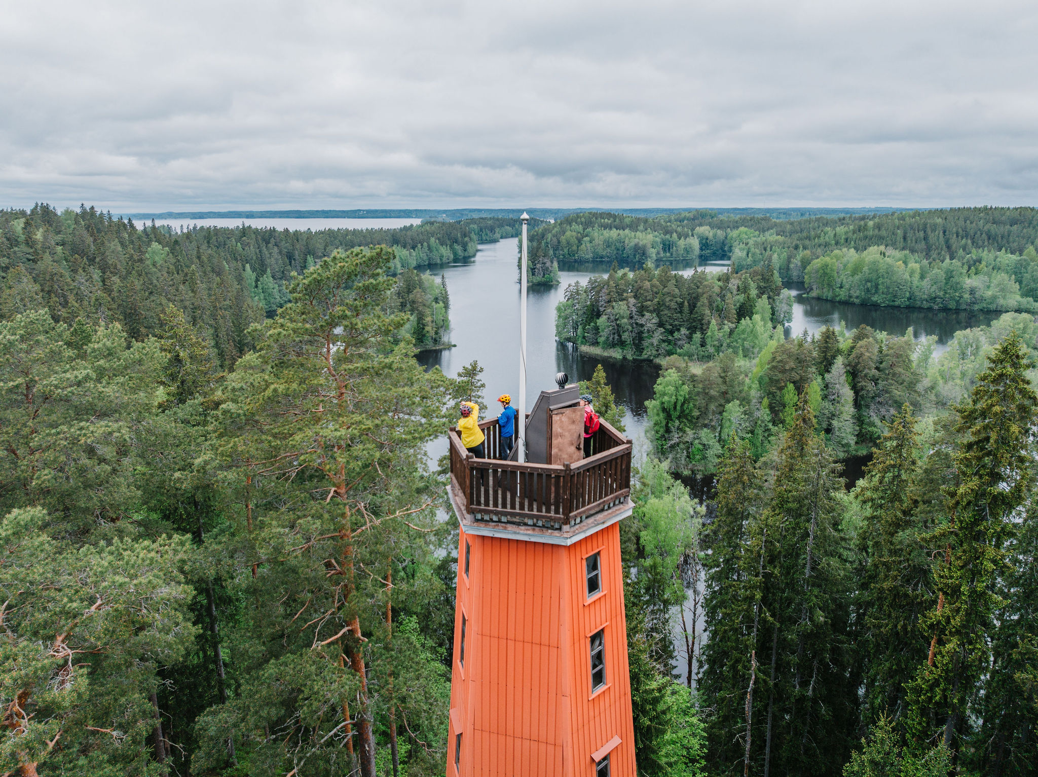
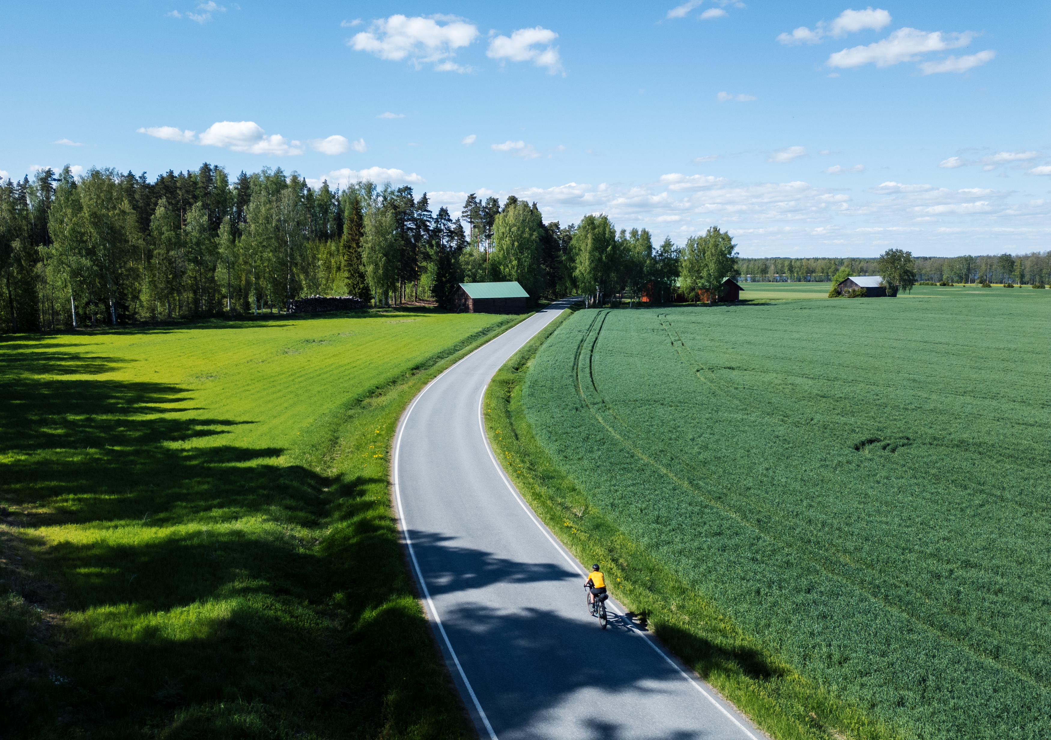
The old Viking Age Hämeen Härkätie ox road leads you towards Saari Folk Park, where Kaukolanharju Observation Tower offers some of the most spectacular views of the route over the forests, lakes, and marshes of Häme Lakeland. The route to Tammela follows a paved road through rural landscapes.
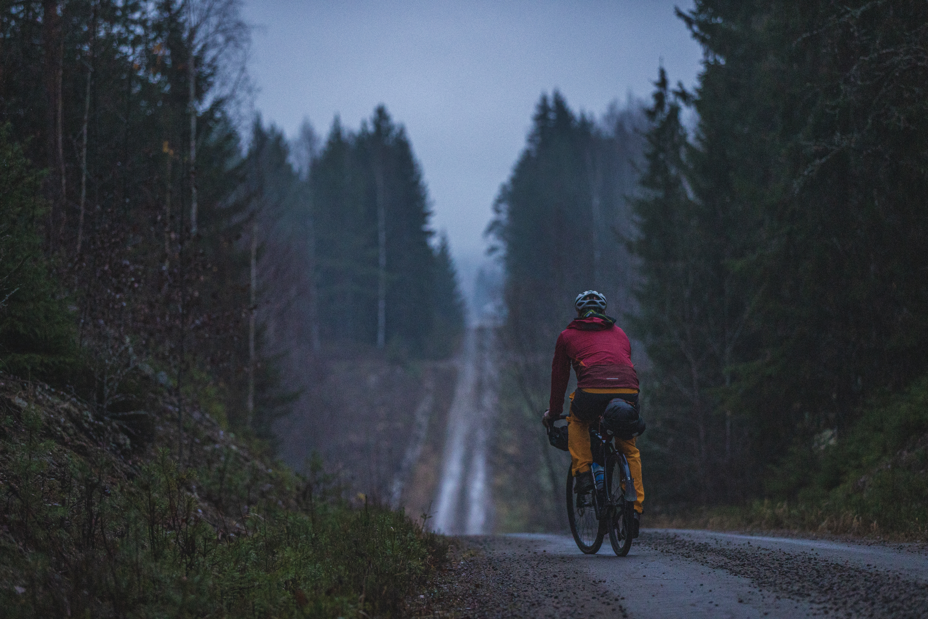
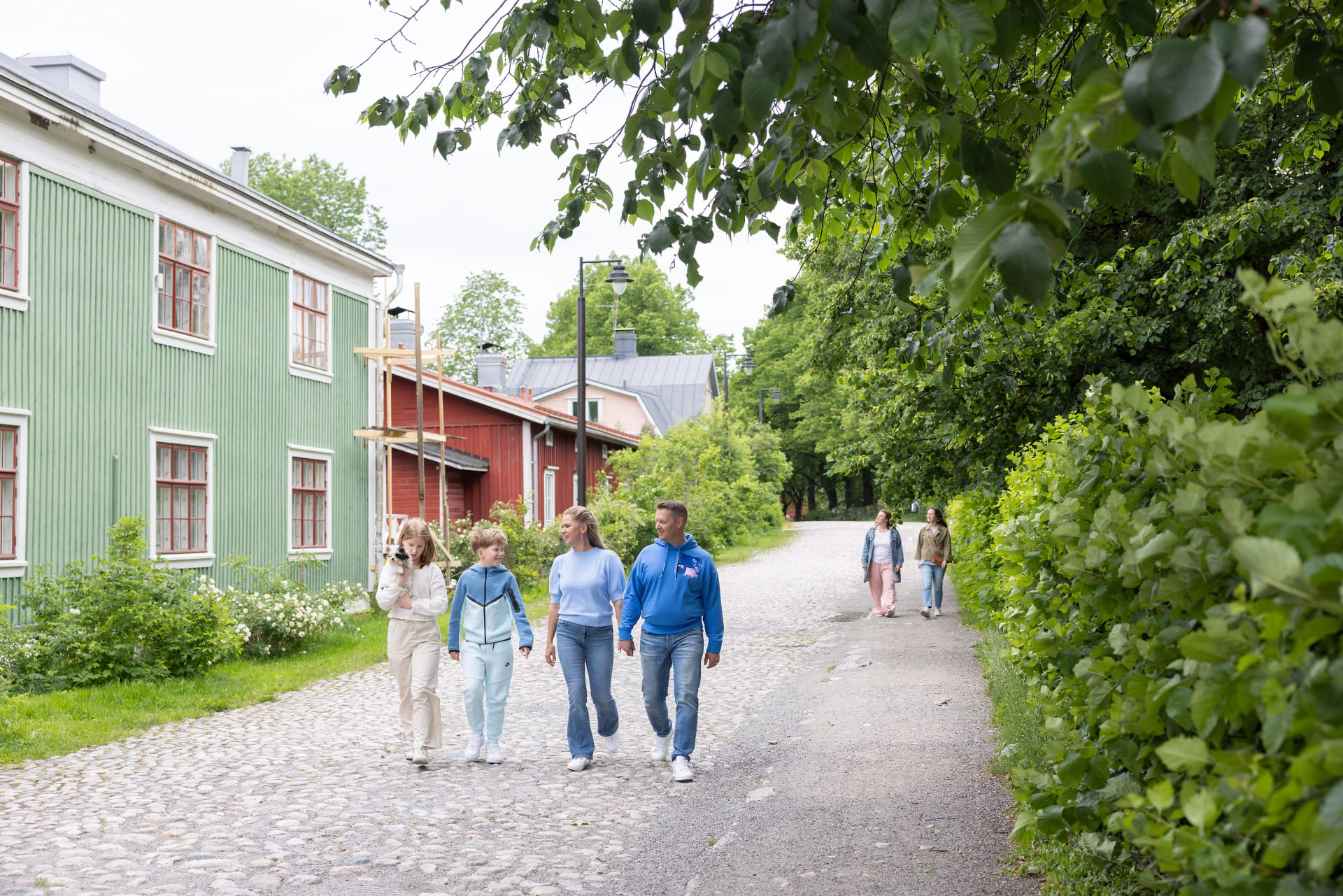
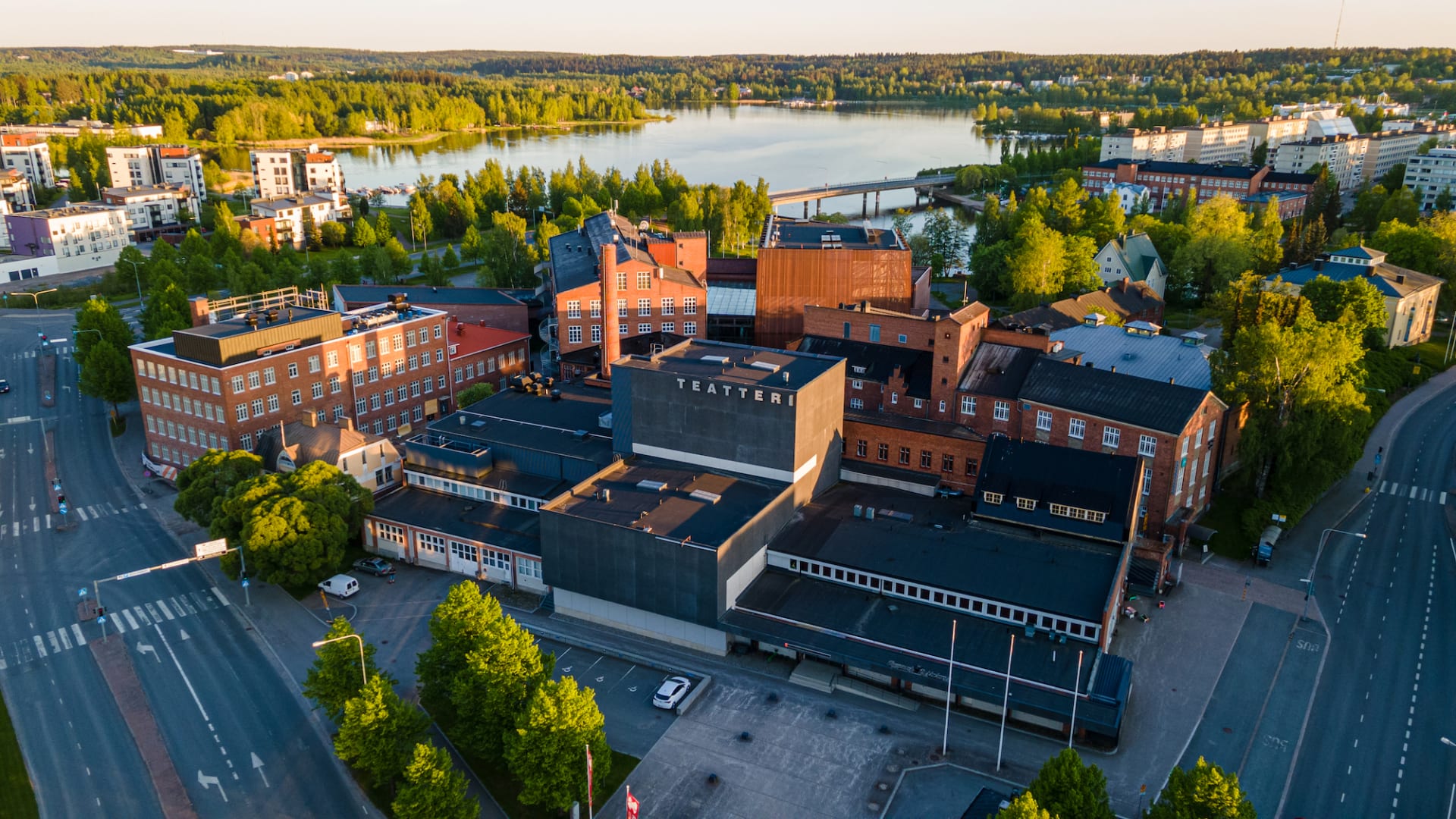
From Tammela, the route continues along the old church path towards Forssa. There, the route intersects with the industrial history of the town: the old spinning mill area and Mustiala Manor invite you to explore the everyday life of the past. From Mustiala, the route returns to the historic Hämeen Härkätie ox road where road sections vary from paved roads to hard-surface tracks and hilly dirt roads.
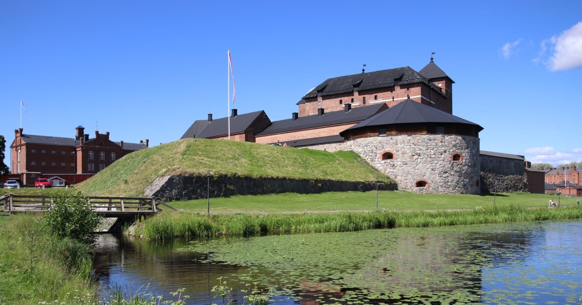
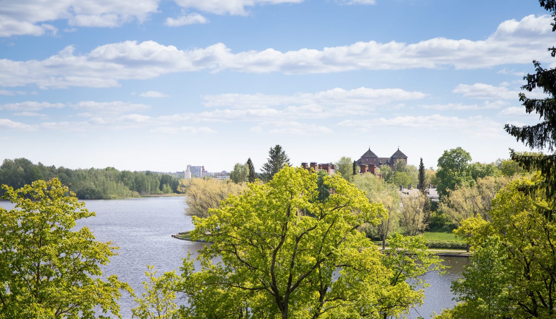
In Hämeenlinna, Ahvenisto’s ridges feature trail climbs and technical terrain, after which you can rest and take a break swimming in the lake. In the city, you will find cafés and restaurants, the medieval Häme Castle, and an opportunity to top up provisions or enjoy a short rest in a cultural setting.
On the last stretch from Hämeenlinna back to Riihimäki, the route leads past the historic Vanajanlinna and Harviala Manors, skirting Lake Katumajärvi along cycle paths and dirt roads. After Kiipula, the route follows dirt roads alongside ridges shaped by the Ice Age. These areas have been inhabited and used by people since the Stone Age. Before the end of the route, Riihimäki offers you a chance to stop and refresh yourself at Kolmilammi dancing parlour surrounded by three lakes, and admire the rural landscape of Ryttylä.
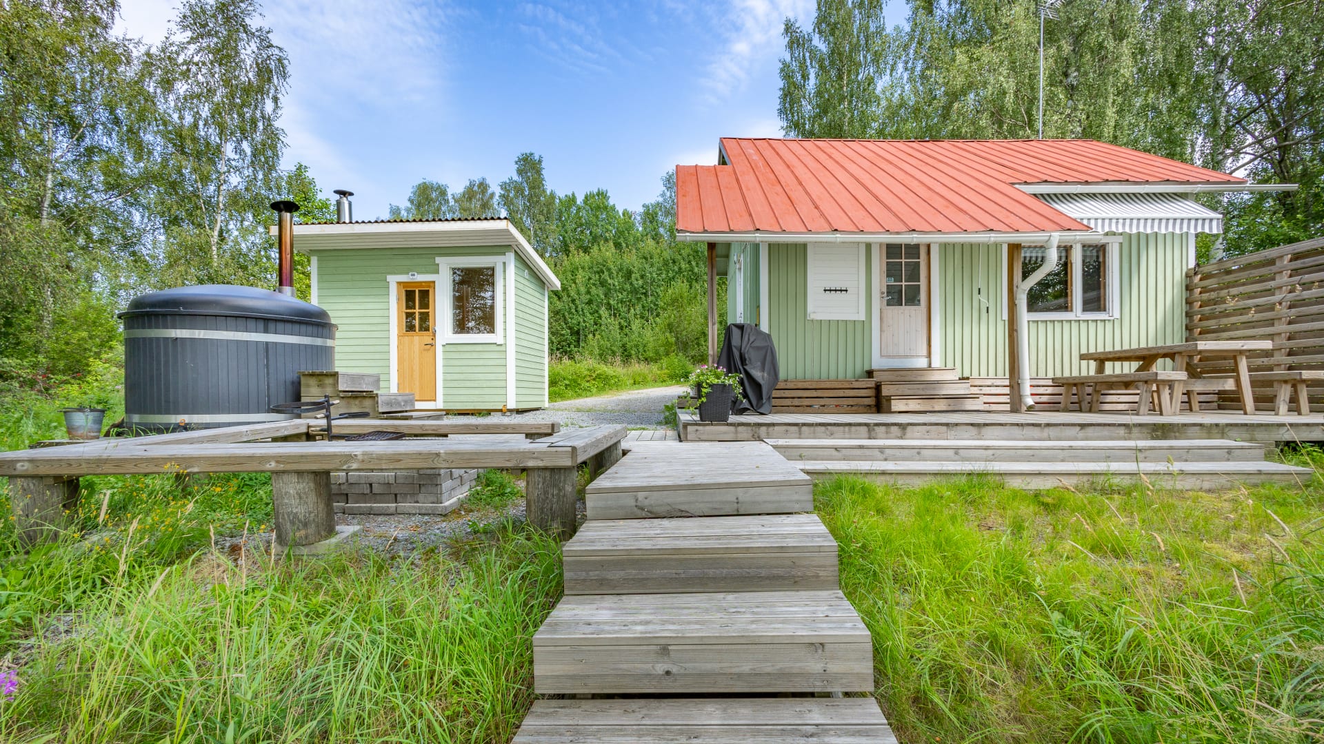
The route is at its best when you combine accommodation at nature sites and guesthouses or hotels. Accommodation and eating options are available along the route, especially in Riihimäki, Forssa, and Hämeenlinna, but there are also options in Loppi, Tammela, Renko, Turenki, and Kiipula. Food and water supplies should be planned in advance, especially between Forssa and Hämeenlinna, where services along the route are few and far between.
East Strider’s Trail is accessible by train: there are good train connections to Hämeenlinna and Riihimäki from Helsinki and Tampere. Local trains also stop along the way at Ryttylä and Turenki stations. There is a bus connection to Forssa from Helsinki. The route can be cycled both clockwise and anticlockwise, and it can be divided into sections or combined with other sections of the Häme by Cycle route if needed.
East Strider’s Trail follows old trade routes through forests and rural landscapes. It is suitable both for the more experienced solo adventurer and for those who enjoy a more leisurely pace – overnighting in a tent or between the sheets.
Read moreHighlights
Honest gravel roads of Tavastia Proper at their best: low-traffic, varied, and well maintained
Saari Folk Park, Komio Nature Reserve, and Pääjärvi Recreation Area
The dramatic esker landscapes of Ahvenisto and the Salpausselkä ridge in Turenki
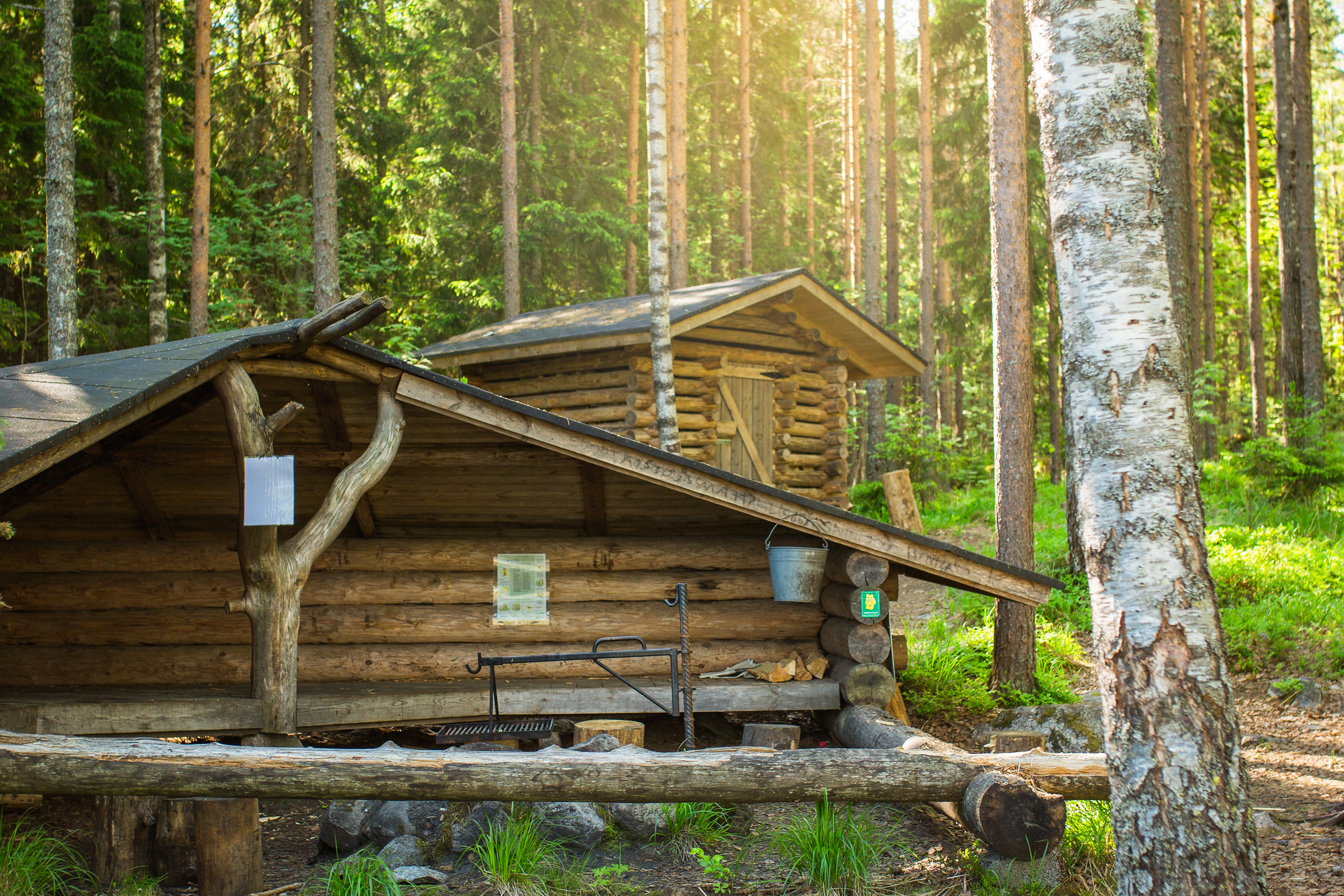
Multiple lean-tos and campfire sites providing versatile overnight options
Information
Arrival
Excellent public transport connections make the trail easily accessible for cyclists from all over Finland. There are four railway stations along the route. By train: The four stations along the route make it easy to start your ride or cycle just a section of the trail. You can begin your journey from any station. Most long-distance trains stop at Hämeenlinna and Riihimäki, while Turenki and Ryttylä are served by local trains running between Helsinki and Tampere. Stations along the route: Riihimäki, Hämeenlinna, Turenki, Ryttylä On local trains, bicycles can be carried free of charge without a reservation. On long-distance trains, a ticket and a bike reservation are required. Be sure to book well in advance—especially in summer and on weekends, when bike spaces may sell out quickly. Check current timetables: 👉 vr.fi By bus: You can easily start or end your cycling trip in Hämeenlinna or Riihimäki, both of which have regional bus connections. Direct express bus services also run from Helsinki, Tampere, and Lahti, making it simple to reach the trail without a car. The bus stations in Hämeenlinna and Riihimäki serve as natural entry and exit points for the trail. Buses via Turenki also provide convenient access, for example for shorter tours or day rides. Check routes and timetables: 👉 matkahuolto.fi 👉 perille.fi By car: The route can be started at many different points—check local parking regulations in advance. Towns and villages along the trail make good starting locations. Parking areas are best checked online beforehand, and always confirm that the location suits your needs. Long-term parking is generally available in towns, often near railway stations. Motorhome and caravan parks can be found along the route in Loppi, Tammela, Hämeenlinna, and Janakkala.
Route duration
3 - 5 days
Route's length km
263
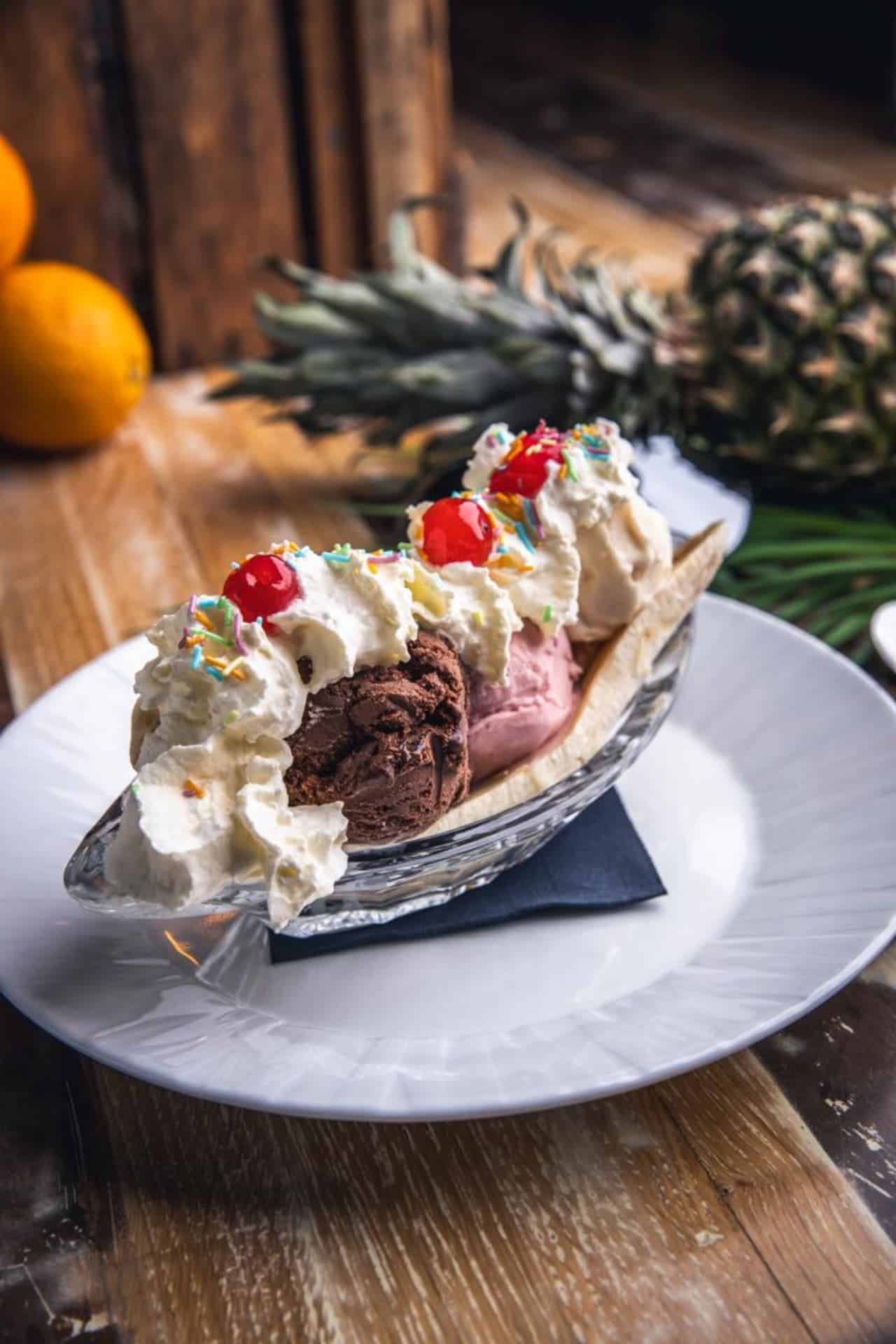
Nearby services
-
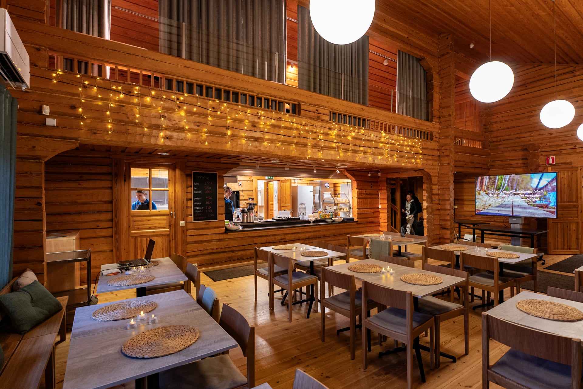
Cafe at Aulanko Nature park
Cafe at Aulanko nature sports centre is a warm...
Read more Cafe at Aulanko Nature park -
Nature360 Equipment Rental – Aulanko, Hämeenlinna
Nature 360’s equipment rental makes spending time in nature...
Read more Nature360 Equipment Rental – Aulanko, Hämeenlinna -
Winter Equipment Rental – Aulanko Nature Reserve, Hämeenlinna
Nature 360’s winter equipment rental makes enjoying winter nature...
Read more Winter Equipment Rental – Aulanko Nature Reserve, Hämeenlinna -
Café-Restaurant Pikku Pistrina
Pikku Pistrina is a café-restaurant located in the center...
Read more Café-Restaurant Pikku Pistrina -
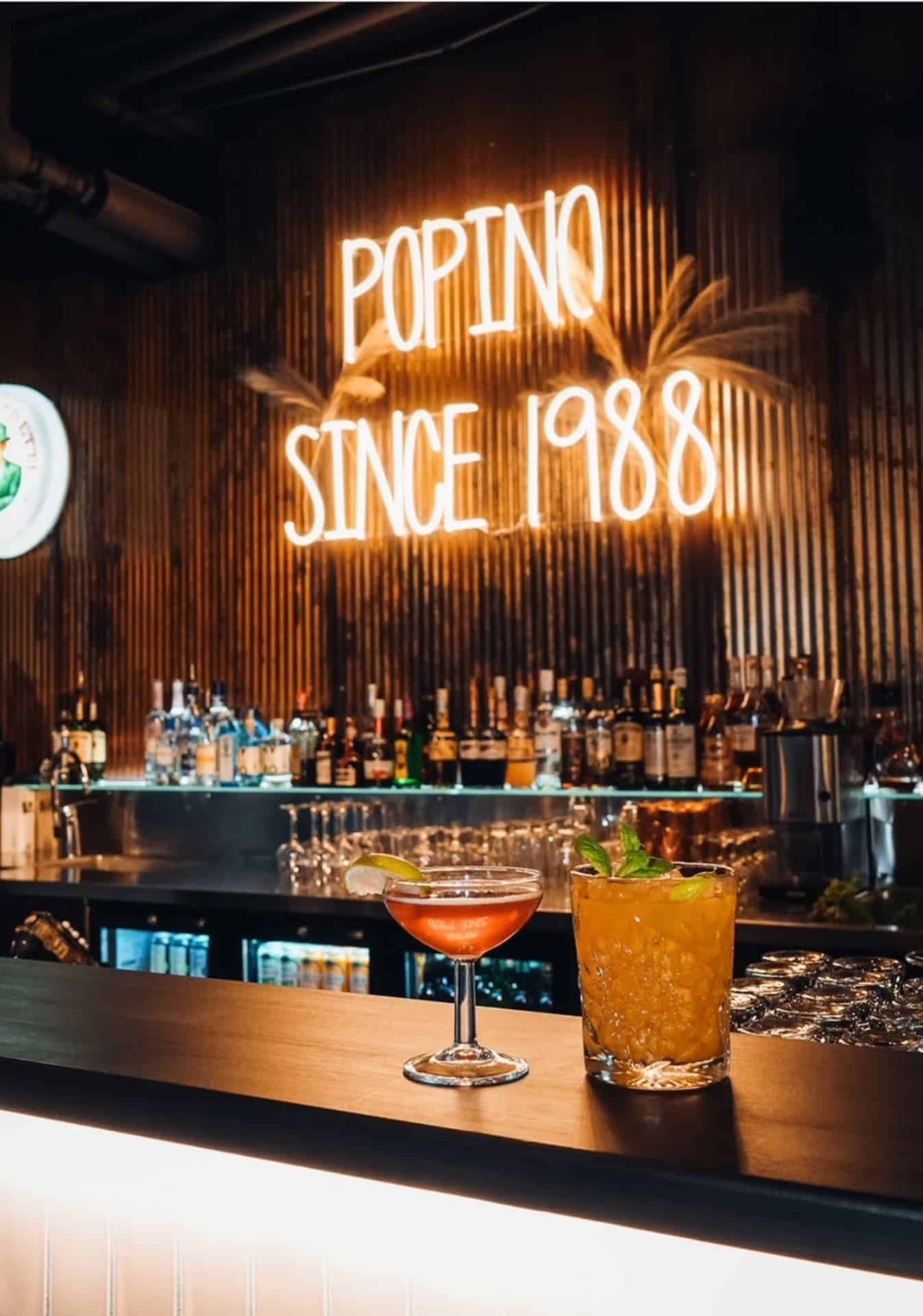
Restaurant Popino
High-quality food made from good ingredients and solid service...
Read more Restaurant Popino -
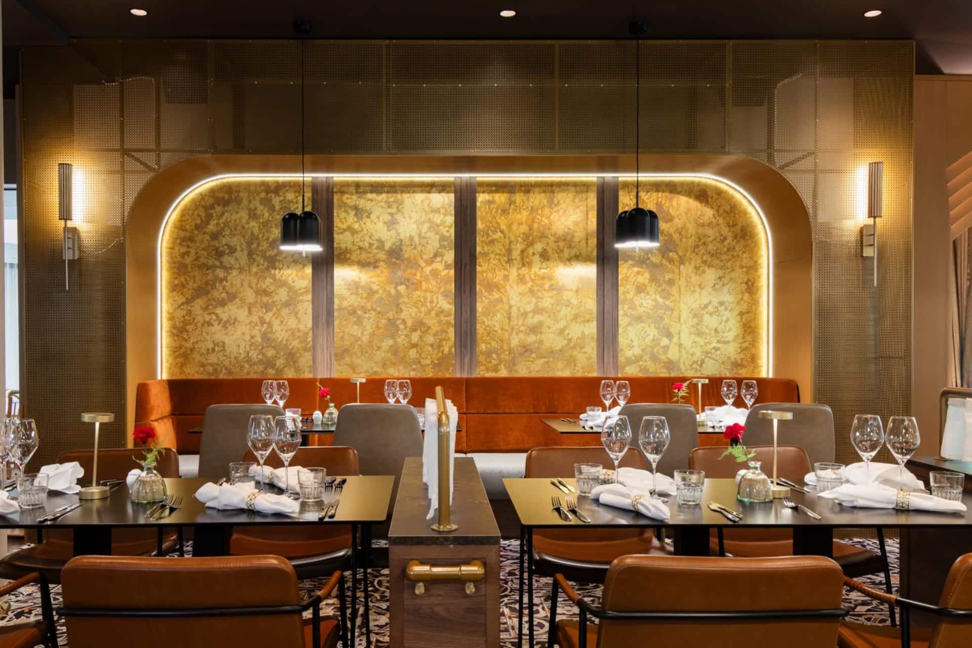
Restaurant Carni
Carni – Hämeenlinna’s Meat Restaurant
Read more Restaurant Carni
Carni is located in the... -
Tervaniemi and Soininsaari Recreation Area
Tervaniemi and Soininsaari Recreation Area is a versatile recreation...
Read more Tervaniemi and Soininsaari Recreation Area -
Summer Cafe Crown’s Bakery
Summer Café Crown's Bakery is open in the historic...
Read more Summer Cafe Crown’s Bakery -
Las Palmas Hämeenlinna
Relaxed flavours of the south and karaoke at Raatihuoneenkatu...
Read more Las Palmas Hämeenlinna -
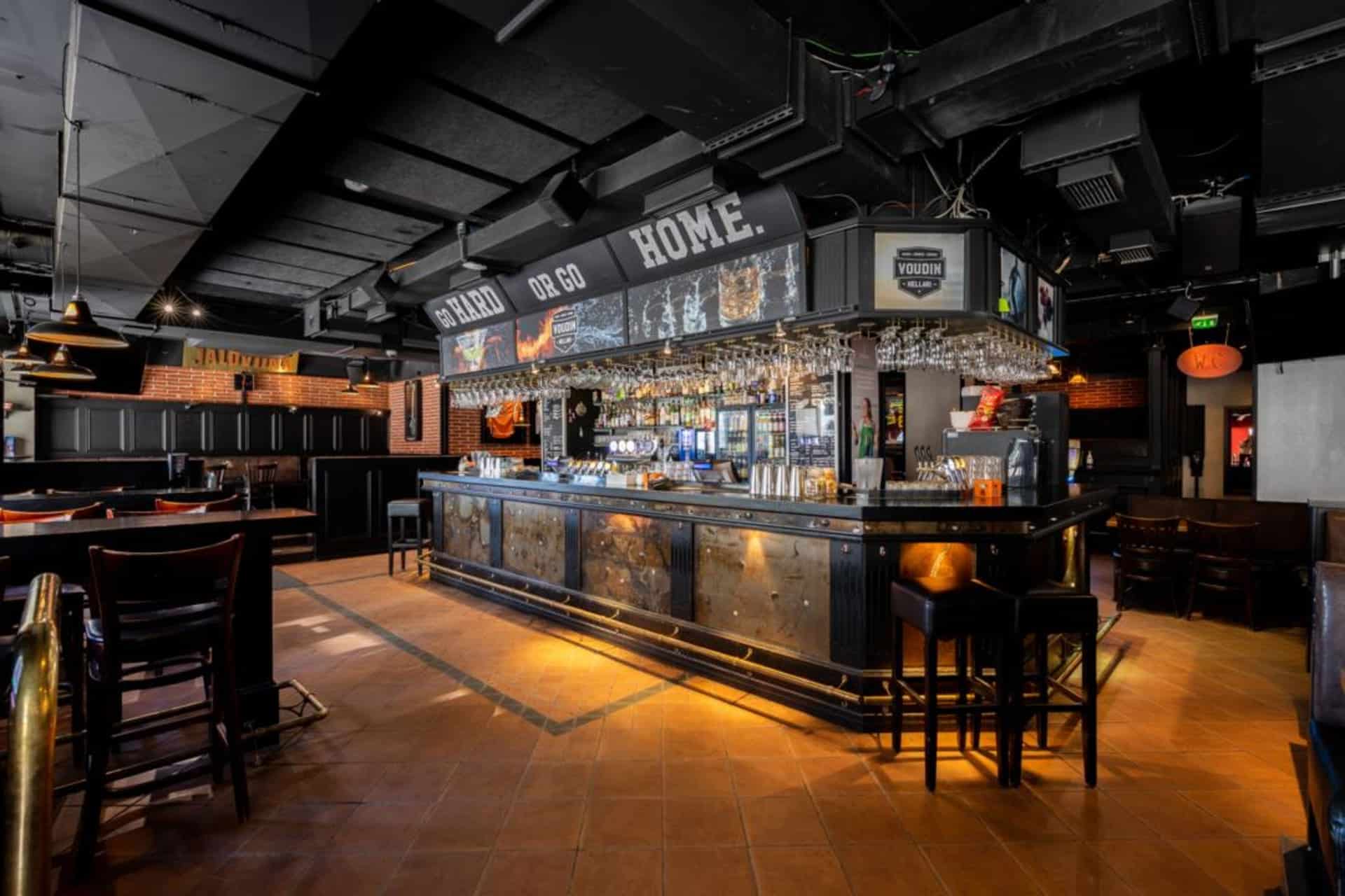
Voudin Kellari Hämeenlinna
MUSIC AND SPORT COME TOGETHER AT VOUTI – YOU...
Read more Voudin Kellari Hämeenlinna -

Restaurant Carl Wilhelm Vanajanlinna
You are warmly welcome to restaurant Carl Wilhelm in...
Read more Restaurant Carl Wilhelm Vanajanlinna -

Villaforss Xmas Menu
Wellcome to enjoy our Christmas Menu during 10.12.- 11.12.2025...
Read more Villaforss Xmas Menu -
 Tervetuloa pyöräilijä
Wisahovi Banquet Hall
Wisahovi Banquet hall is a venue for private parties....
Read more Wisahovi Banquet Hall -

Forssa National Urban Park
Welcome to Forssa National Urban Park. Its history tells...
Read more Forssa National Urban Park -

Forssa Museum Pattern Centre
Pattern Centre is the home of the Forssa museum's...
Read more Forssa Museum Pattern Centre -

The Finnish Glass Museum
The Finnish Glass Museum is a museum with national...
Read more The Finnish Glass Museum -
 Tervetuloa pyöräilijäSustainable Travel Finland
Scandic Aulanko
A fabulous conference and spa hotel that caters to...
Read more Scandic Aulanko -

Hämeenlinna Art Museum
The wonderful Hämeenlinna Art Museum is located in the...
Read more Hämeenlinna Art Museum -
 Sustainable Travel Finland
Restaurant Le Blason
Le Blason brings a whiff of fragrant herbs and...
Read more Restaurant Le Blason -
 Sustainable Travel Finland
Original Sokos Hotel Vaakuna, Hämeenlinna
Original Sokos Hotel Vaakuna, Hämeenlinna - The happiest lake...
Read more Original Sokos Hotel Vaakuna, Hämeenlinna -
Hämeenlinna National Urban Park
The very first NUP in Finland is a ‘show...
Read more Hämeenlinna National Urban Park -

Miller’s BBQ
Barbecue restaurant in the cozy setting of Hämeenlinna's Kruununmylly...
Read more Miller’s BBQ -

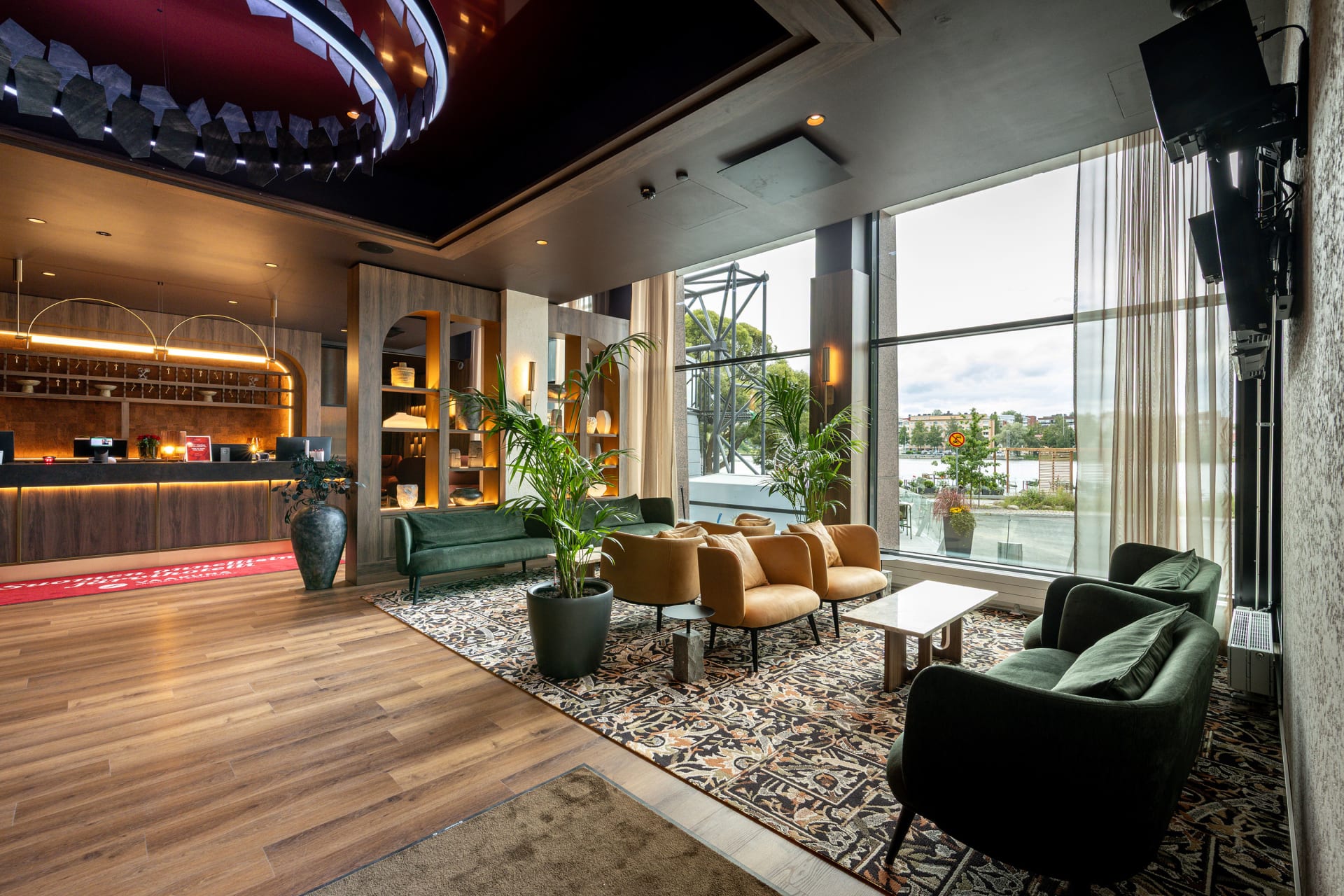
Finlandia Hotel Seurahuone Riihimäki
Hotel Seurahuone has long traditions and it is located...
Read more Finlandia Hotel Seurahuone Riihimäki -

Svenni Eatery Hämeenlinna
Come and enjoy our atmospheric cerllar restaurant!
Read more Svenni Eatery Hämeenlinna
Svenni Eatery is... -

Ahvenisto Outdoor and Nature Reserve
Ahvenisto Ridge area is a popular outdoor district in...
Read more Ahvenisto Outdoor and Nature Reserve -

Aulanko Nature Reserve
Aulanko has been a popular destination with visitors for...
Read more Aulanko Nature Reserve -

Accommodation at Tiirinkosken Tehdas
Accommodation at Tiirinkoski
Read more Accommodation at Tiirinkosken Tehdas
Have you always wanted to stay in... -

Tiirinkoski Factory
Located in Hämeenlinna, the Tiirinkoski factory exudes a warm...
Read more Tiirinkoski Factory -
Riihimäki Railway Park
When you get off the train at Riihimäki railway...
Read more Riihimäki Railway Park -

Aulanko Lakeside
THE AULANKO LAKESIDE consists of four buildings and offers...
Read more Aulanko Lakeside -

Hyttikortteli in Riihimäki
Walk down the narrow alleys of Hyttikortteli, sense the...
Read more Hyttikortteli in Riihimäki -
Aulanko Lake Hide-out
The Aulanko Lake Hide-out is an accommodation complex located...
Read more Aulanko Lake Hide-out -

Hotel Vanajanlinna
Hotel Vanajanlinna in Hämeenlinna is a full-service hotel and...
Read more Hotel Vanajanlinna -

Restaurant Villa
Stylish surroundings, immediate and warm service and, above all,...
Read more Restaurant Villa -

Restaurant Obelix Riihimäki
Ravintola Obelix is a cozy Restaurant serving a tasty...
Read more Restaurant Obelix Riihimäki -

Wetterhoff House
Wetterhoff House is a combination of traditional craftsmanship and...
Read more Wetterhoff House -

Sibelius Forest
Sibelius Forest is a nature reserve of approximately 100...
Read more Sibelius Forest -

Holy Cross Church in Hattula
Holy Cross Church in Hattula serves as one of...
Read more Holy Cross Church in Hattula -

Skogster Museum
Skogster Museum is the main location of Hämeenlinna City...
Read more Skogster Museum -

Forssa Spinning Mill
Visit museums and exhibitions, and enjoy refreshments at the...
Read more Forssa Spinning Mill -

Sibelius Park in Hämeenlinna
Sibelius Park is a beautiful small park located in...
Read more Sibelius Park in Hämeenlinna -

Museo Militaria – The Artillery, Engineer and Signals Museum of Finland
Museo Militaria is a war history museum showcasing the...
Read more Museo Militaria – The Artillery, Engineer and Signals Museum of Finland -

B & B Matin ja Maijan Majatalo
In our hospitable bed and breakfast, You will be...
Read more B & B Matin ja Maijan Majatalo -

Restaurant Tallitupa
Custom restaurant for groups, business meetings and family party....
Read more Restaurant Tallitupa -

Vanai Bistro & Bastu Restaurant
Vanai Bistro & Bastu is a family business that...
Read more Vanai Bistro & Bastu Restaurant -

Scandic Hämeenlinna City
A cosy and versatile hotel in the best location...
Read more Scandic Hämeenlinna City -

Aulanko Lake Villa
AULANKO LAKE VILLA is the centre of tranquillity with...
Read more Aulanko Lake Villa -

Café Kukko, Hämeenlinna
We at Café Kukko want to bring more great...
Read more Café Kukko, Hämeenlinna -

Pub Albertin Kellari
Pub Albertin Kellari, located in the basement of the...
Read more Pub Albertin Kellari -

Honkalanranta Nature Reserve
Honkalanranta is a private nature reserve located on the...
Read more Honkalanranta Nature Reserve -

Vanajanlinna Restaurant
Vanajanlinna in Hämeenlinna is a full-service hotel, restaurant and...
Read more Vanajanlinna Restaurant -
 Tervetuloa pyöräilijä
Myllytalo
Myllytalo (Finnish for Millhouse) is located in Hämeenlinna, just...
Read more Myllytalo -

Ateljee Tiriteijaa Studio
Welcome to visit my studio at Hämeenkatu 9-15, Riihimäki....
Read more Ateljee Tiriteijaa Studio -

Aulanko Outdoors Equipment Rental
Sports equipment rental at Aulanko, Hämeenlinna.
Read more Aulanko Outdoors Equipment Rental
Want to explore... -

The Hunting Museum of Finland
This is an indoor wilderness experience only about one...
Read more The Hunting Museum of Finland -

Kultakukkura Villas
Cosy and Modern Kultakukkura Villas by the Lake Pyhäjärvi.
Read more Kultakukkura Villas
These... -

Hevossilta Wooden Cabins
We have 6 log cabins for rent all year...
Read more Hevossilta Wooden Cabins -

Aulanko Grand Villa
AULANKO GRAND VILLA is located in Aulanko Peace Area...
Read more Aulanko Grand Villa -

Restaurant Piparkakkutalo
Restaurant Piparkakkutalo is located in a historical house. The...
Read more Restaurant Piparkakkutalo -

Birthplace of Jean Sibelius
Discover the first twenty years of famous composers life...
Read more Birthplace of Jean Sibelius -

Aulangon Tornikahvila
Lookout Cafe Aulanko - an oasis in the national...
Read more Aulangon Tornikahvila -

Pilvenmäki Racecourse
Pilvenmäki harness racing racecourse is situated in Pilvenmäki district...
Read more Pilvenmäki Racecourse -
Hämeenlinna Theater
The 125-year-old Hämeenlinna Theatre offers a distinctive and artistically...
Read more Hämeenlinna Theater -

Rantakasino, Summer Restaurant
Famous summer restaurant in the heart of Hämeenlinna, by...
Read more Rantakasino, Summer Restaurant -

Aulanko Tower
Aulangonvuori Hill is dominated by a 33-metres-tall granite tower...
Read more Aulanko Tower -

Verkatehdas Restaurant
Verkatehdas Restaurant is a versatile restaurant located in Verkatehdas...
Read more Verkatehdas Restaurant -

Ronttismäki Factory Worker’s House Museum
Experience the living of local industrial workers and craftsmen...
Read more Ronttismäki Factory Worker’s House Museum -

Fifth Avenue Diner
Make a journey through the USA with us. FA-restaurant...
Read more Fifth Avenue Diner -

Villaforss Summer Restaurant
Welcome to the beautiful English garden of Villaforss and...
Read more Villaforss Summer Restaurant -

Hämeenlinna Travel Park
Travel park is open during the summer season 1.5.-30.9.2023
Read more Hämeenlinna Travel Park
During... -

Galleria Paperihuone
Galleria Paperihuone is an art gallery located in the...
Read more Galleria Paperihuone


More nature sites
-
lean-to, goahti (lapp tent shelter) or 'kammi' earth lodge
Määkynmäki lean-to
Hakoistentie 371 , Janakkala
Read more about the nature activity Määkynmäki lean-to -
 array(0) {
}
swimming site
array(0) {
}
swimming siteSähkönokka swimming area
Räyskäläntie 682 , Loppi
Read more about the nature activity Sähkönokka swimming area -
 array(0) {
}
biking route
array(0) {
}
biking routeKalvola Church Trail
- , Tammela
Kalvola Church Trail follows the old route from Tammela to Kalvola Church through the historical landscapes of Kanta-Häme. The...
Read more about the nature activity Kalvola Church Trail -
 array(0) {
}
lean-to, goahti (lapp tent shelter) or 'kammi' earth lodge
array(0) {
}
lean-to, goahti (lapp tent shelter) or 'kammi' earth lodgeMyllylahti lean-to shelter
Härkätie 850 , Tammela
The Myllylahti lean-to shelter where you can sit down, take a break, and enjoy the lake scenery.
Read more about the nature activity Myllylahti lean-to shelter