Häme by Cycle: East Strider’s Trail
Experience Häme’s nature and cultural heritage on a single cycling route
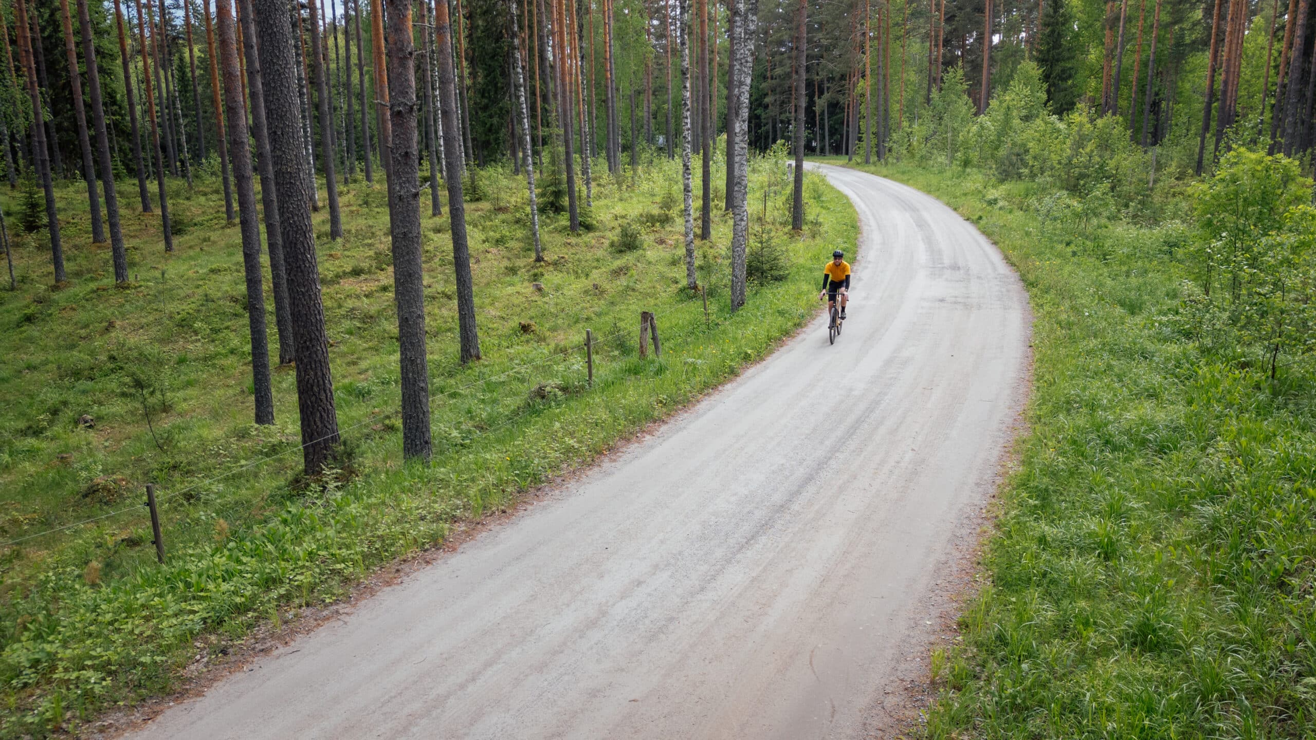
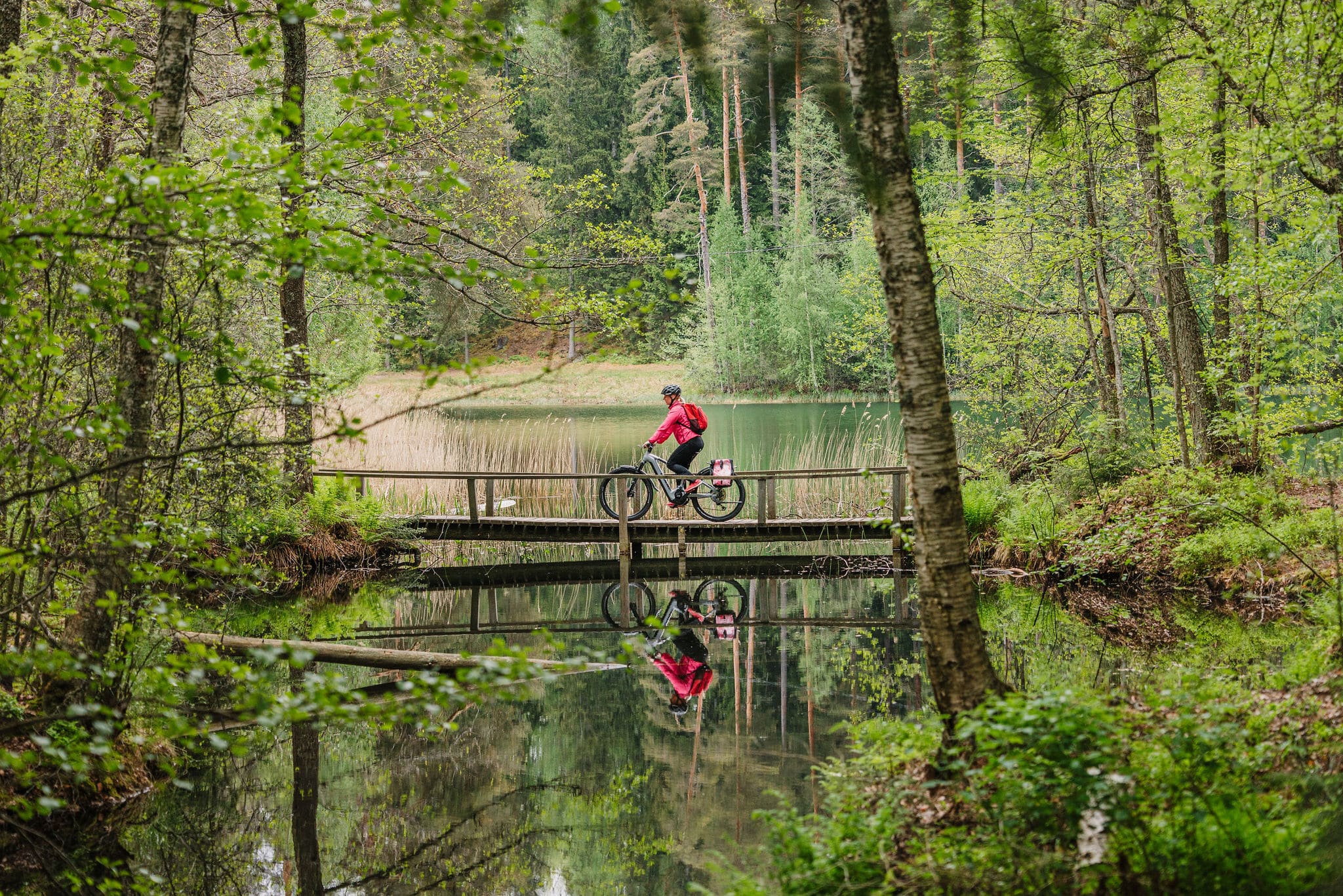
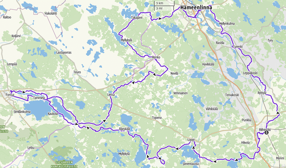
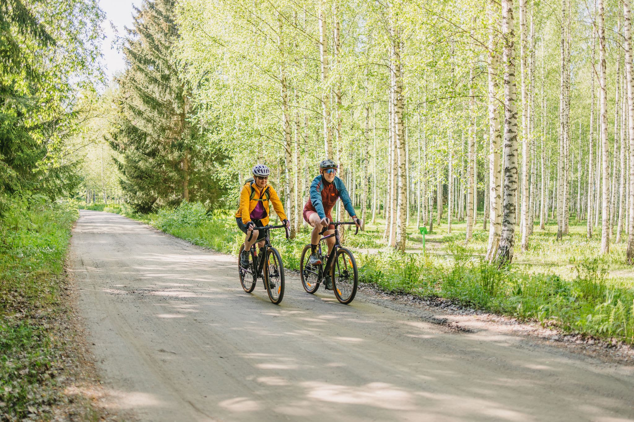
The East Strider’s Trail is a 260 km circular route (3–5 days) with mostly dirt roads through the cultural and historical landscapes, ridges, lakes, and villages of the Häme Lake Uplands. Especially suited for gravel and touring bikes, it brings together urban services, wilderness, cultural sites, and a wide range of accommodation.
From ancient trade routes and forested ridges, the trail unfolds into lakeside villages, cultural landmarks, and tranquil countryside. Whether you choose to camp at lean-tos and campsites or stay comfortably in inns, cottages, and hotels, the route blends adventure, history, and natural beauty—offering both challenge and relaxation for cyclists and bikepackers alike.
Length
263 km
Duration
3-5 days
Total ascent
1962 m
Highest point
149 m
Unpaved
69 %
Singletrack
3 %
Difficulty (1-6)
2-3
Rideable
100 %
At the crossroads of ancient trade routes
In Tavastia Proper, two historic arteries once crossed: the Eastern Trade Route, which carried silver from Byzantium and the Arab world as early as the Viking Age (c. 800–1050), and the Hämeen Härkätie (“Ox Road of Häme”), a medieval route connecting Turku and Häme Castle. Along these roads travelled merchants, pilgrims, and messengers, bringing with them influences that shaped local culture.
During the Iron Age, Häme was part of a vast network linking East and West. Silver, pearls, and treasures flowed into the region, while furs, metalwork, and handicrafts travelled out. Alongside trade came stories, beliefs, and cultural influences that left a lasting mark on the region’s history.
Nature sites and local services
The East Strider’s Trail connects Riihimäki, Loppi, Tammela, Forssa, and Hämeenlinna through charming nature destinations and local services.
Along the route, you will encounter beautiful natural sites such as the Komio Nature Reserve, Saari Folk Park, Pääjärvi Recreation Area, and Ahvenisto Nature Reserve. Parts of the trail also follow the Häme Ox Road, a historic route dating back to the Viking Age.
You can choose to camp in nature and at designated camping areas, or complete the entire journey without a tent by staying in guesthouses and hotels—just be sure to book accommodation in advance. Experienced cyclists will find the route suitably challenging, but it can also be enjoyed at a relaxed pace while taking in the surrounding landscapes.
Route information
The East Strider’s Trail is best suited for bikepackers with some experience of multi-day cycling tours.
Designed to be ridden in 3–5 days in either direction, the route offers flexible overnight options: spend the night under the stars at a lean-to, or rest comfortably in guesthouses and other accommodations. Services and rest stops are spaced at convenient intervals, helping you pace your journey and enjoy well-timed breaks.
A gravel or mountain bike is recommended for this route.
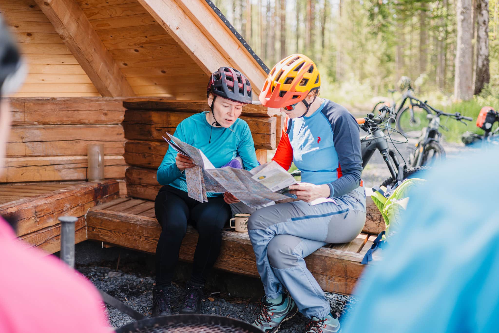
Scroll down for a detailed route description at the bottom of this page.
Highlights
- The best gravel roads of Kanta-Häme – peaceful, varied, and well-maintained
- Saari Folk Park, Komio Nature Reserve, and Pääjärvi Recreation Area
- Get to know the story of Häme Ox Road in Rauniotie, a forested section of the historic trade route (in Finnish)
- Majestic forest landscapes of Ahvenisto and Turenki
- Numerous summer cafés and museums offering well-deserved breaks along the daily stages
- Multiple lean-tos and campfire sites providing versatile overnight options
- Crystal-clear small lakes and wilderness areas in Loppi
- Cultural and museum attractions in nearby towns
Good to know
- The route can be cycled in three seasons – spring, summer, and autumn – with the best conditions from May to September.
- Navigation is provided only digitally. Read Bikeland.fi’s instructions and tips for successful route navigation.
- Any well-maintained touring, gravel, or mountain bike is suitable. Tires should be at least 40 mm wide and puncture-protected. For comfort, it’s best to use bikepacking bags instead of a backpack.
- Always stay on the marked route and use only the recommended campsites and rest areas listed in the route description.
- Respect the fragile nature and rural surroundings — never leave litter behind.
Follow the general Outdoor Etiquette and the Mountain Biking Etiquette, and show respect for farm machinery by waiting until it has cleared the road before continuing. - Along the trail, there are several sites worth visiting on foot. Bring walking shoes and a lock for securing your bike when stopping.
- There are fire pits along the route, but wood supply varies. Carrying a camping stove is recommended. Fires are allowed only in designated places, and open fires are strictly prohibited during wildfire warnings. Information on local fire warnings can be found on the Finnish Meteorological Institute’s website.
- Mobile network coverage is good throughout most of the route. If the 112 app does not work, call the emergency number 112 directly. Always use the 112 app when possible, as it automatically provides your location.
- The route crosses busy roads such as Highway 12 and Main Roads 54 and 53. Extra caution is required at these crossings.
- Check the weather forecast before setting out and bring gear suitable for the conditions. Always inform someone of your plans and estimated arrival time before you start your ride.
- Swimming opportunities are available in many places along the route. Information about parks and nature sites is provided on local info boards and at Luontoon.fi.
- The route runs not only on public roads but also on private roads maintained by local road associations. If you encounter poorly maintained sections, please inform us at info@hvay.fi so we can update the route condition information.
Accommodation
- Along the route, you will find guesthouses, rental cottages, farm stays, as well as lean-tos and huts. Accommodation options range from budget to premium, with generally excellent value for money. It is recommended to book in advance and confirm the possibility of storing your bike.
- Camping is permitted free of charge at designated sites unless you are staying at a serviced campsite or at a tent site connected to an accommodation provider.
- Please follow the Outdoor Etiquette and respect the rules of different parks and recreational areas.
- Most campfire sites are equipped with firewood and a dry toilet, but firewood may occasionally run out. Carrying a camping stove is therefore recommended.
- Check the camping sites and their regulations from Luontoon.fi.
Food & drink
- Restaurants, cafés, and shops can be found in towns and villages along the route or nearby.
In rural areas, opening hours may vary by season, so it is advisable to plan ahead and check up-to-date information before your trip. - Most restaurants, cafés, kiosks, and shops along the route are willing to refill your water bottles. However, it is recommended to carry food and drinks for at least one day. When planning overnight stays or cycling on hot summer days, water needs increase – we recommend having a capacity of at least three litres to reduce the risk of running out, especially on quieter stretches of the trail.
- At lean-tos and campfire sites, always check the current wildfire warnings. Lighting open fires is prohibited during wildfire warnings, including at most designated campfire sites. Up-to-date information is available from the Finnish Meteorological Institute.
- If you plan to camp, note that recommended camping sites usually do not provide drinking water. Carry water with you from the previous refill point. Natural water sources such as lakes must always be purified before use – either by boiling or with purification equipment.
- Grocery stores can be found in Riihimäki, Loppi, Tammela, Forssa, Renko, Hämeenlinna, Turenki, and Ryttylä.
Difficulty
The route consists mainly of technically easy gravel roads and comparable forest roads. Its length and location require at least two nights of self-supported accommodation. In towns and villages, the trail mostly follows paved roads, with only a small number of easy singletrack sections. Climbs are typically short in southern Finland.
The recommended minimum tyre width is 40 mm, although experienced riders may manage with narrower tyres. The route can be ridden in both directions without significantly affecting the length of riding days.
⚠️ Be cautious at road crossings and note that many village roads have narrow shoulders.
Major road crossings along the route:
- The trail crosses busy roads such as Highway 10 and Regional Roads 54 and 130, where extra care is required.
- When arriving in Riihimäki from Hämeenlinna, be especially mindful of heavy traffic after crossing Road 54 and stay strictly on the marked trail.
- On the ascent to Ahvenisto Ridge and at a few points along the ridge, you will encounter short technical sections.
- At Luutasuo in Loppi, fine sand may cause narrow tyres to sink depending on the season.
- In Forssa, parts of Syrjäharju in Tammela include more technical singletrack with small rocky patches.
- At Uudensillanmäki in Tammela, a stony path and steep climb may require pushing the bike.
The trail is rated 2–3 in difficulty. You can find the full difficulty classification table at Bikeland.fi.
Arrival
Excellent public transport connections make the trail easily accessible for cyclists from all over Finland. There are four railway stations along the route.
By train:
The four stations along the route make it easy to start your ride or cycle just a section of the trail. You can begin your journey from any station. Most long-distance trains stop at Hämeenlinna and Riihimäki, while Turenki and Ryttylä are served by local trains running between Helsinki and Tampere.
Stations along the route: Riihimäki, Hämeenlinna, Turenki, Ryttylä
On local trains, bicycles can be carried free of charge without a reservation. On long-distance trains, a ticket and a bike reservation are required. Be sure to book well in advance—especially in summer and on weekends, when bike spaces may sell out quickly.
Check current timetables:
👉 vr.fi
By bus:
You can easily start or end your cycling trip in Hämeenlinna or Riihimäki, both of which have regional bus connections. Direct express bus services also run from Helsinki, Tampere, and Lahti, making it simple to reach the trail without a car.
The bus stations in Hämeenlinna and Riihimäki serve as natural entry and exit points for the trail. Buses via Turenki also provide convenient access, for example for shorter tours or day rides.
Check routes and timetables:
👉 matkahuolto.fi
👉 perille.fi
By car:
The route can be started at many different points—check local parking regulations in advance. Towns and villages along the trail make good starting locations. Parking areas are best checked online beforehand, and always confirm that the location suits your needs.
Long-term parking is generally available in towns, often near railway stations. Motorhome and caravan parks can be found along the route in Loppi, Tammela, Hämeenlinna, and Janakkala.
Route description
Riihimäki – Räyskälä 67 km
Start: Riihimäki Railway Station
The route starts conveniently at Riihimäki railway station, offering excellent connections by public transport. Before heading out, Riihimäki’s services are a good place to stock up on snacks or grab any last-minute bike maintenance supplies.
Hyttikortteli
The first kilometres follow smooth city cycle paths. After about 3 km it’s worth checking your gear and making a short stop at Hyttikortteli, the historic glassworkers’ district. Its atmosphere, architecture and industrial heritage provide a unique cultural backdrop at the beginning of the ride.
Riihimäki Hunting Museum & Finnish Glass Museum
A short distance away you’ll find two museums. The Hunting Museum of Finland showcases Finnish hunting traditions and wilderness culture, while the Finnish Glass Museum is renowned for the artistry of Finnish glassmasters. Both are interesting detours if you have time before continuing the ride.
Paalijärvi & Hirvijärvi Lakes
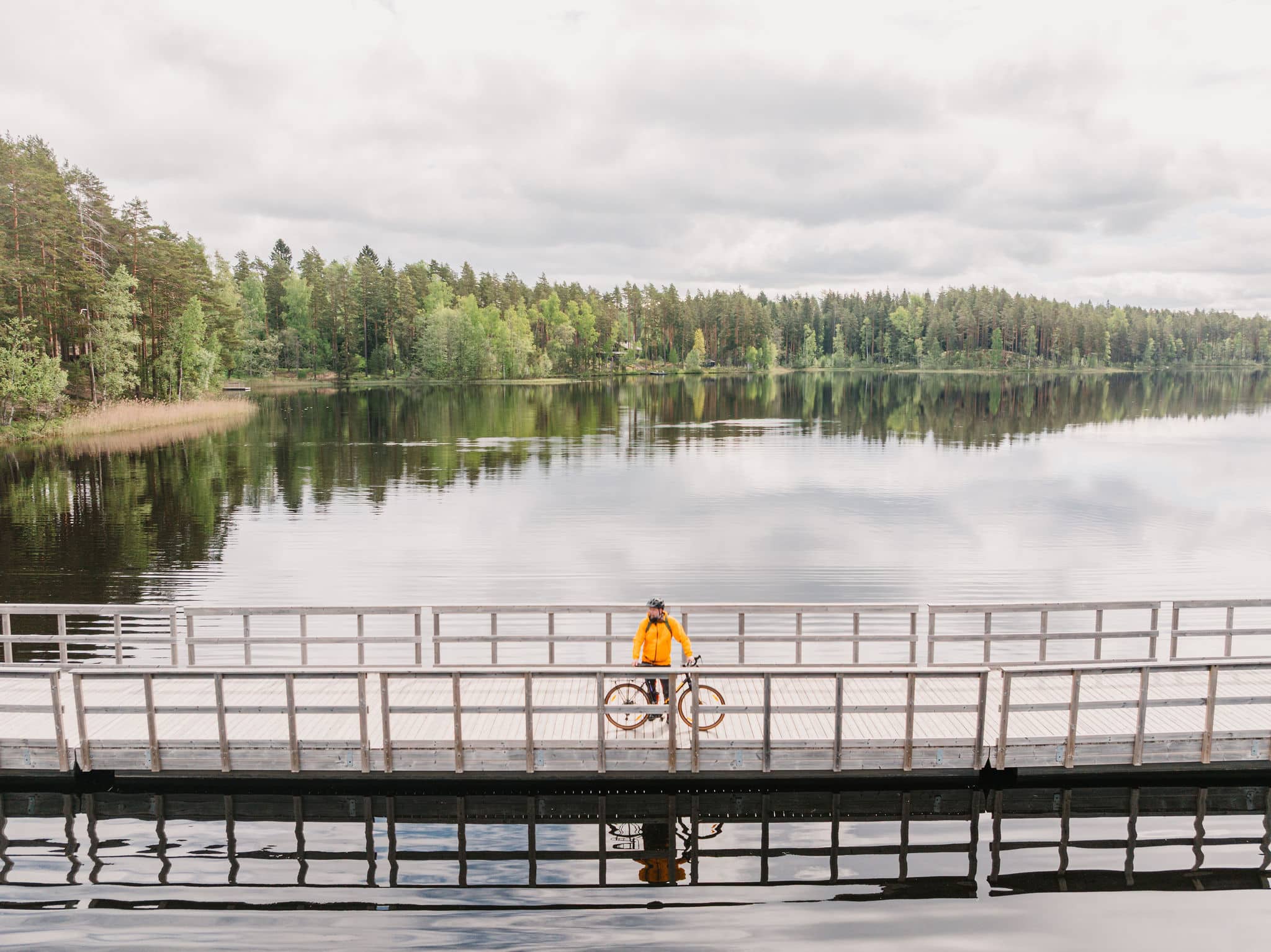
The route shifts from cycle paths onto winding hard-packed gravel roads leading towards Paalijärvi. At Paalijärvi you’ll find a beach and a lean-to shelter – a perfect spot for a break. Just 2 km further is Hirvijärvi, also ideal for swimming or a rest in the peaceful surroundings. Here you can even rent a sauna by the lake. Both locations offer tranquil moments by the water.
Loppi village
From here the route follows well-maintained gravel roads with a few punchy climbs before reaching the shores of Loppijärvi. Continuing along the gravel, you arrive at Vanhankoski mill and power station museum, a site that reflects local history. The village of Loppi, about 35 km from the starting point, is a good place to refill supplies, enjoy a meal, and pause to plan the rest of the day – the next larger grocery store is 60 km away.
Komio Nature Reserve & Luutasuo
After Loppi, the route continues along Pilpalantie towards Komio Nature Reserve. A short but steep gravel climb at Pappilanlääni leads you into Luutasuo, where a campfire site by Luutalampi lake provides a peaceful rest spot. While enjoying your snack, you might see swans taking flight or hear the call of a red-throated diver.
Marked trails start from the Luutasuo parking area – Esteetön Samo (1 km), Pikku-Samo (3.5 km) and Luutaharjun Samo (6.5 km) – most are hiking trails, but some can be explored by bike. Overnight camping is only allowed at Komionlampi camping site.
Marskin Maja & Räyskälä Village Shop
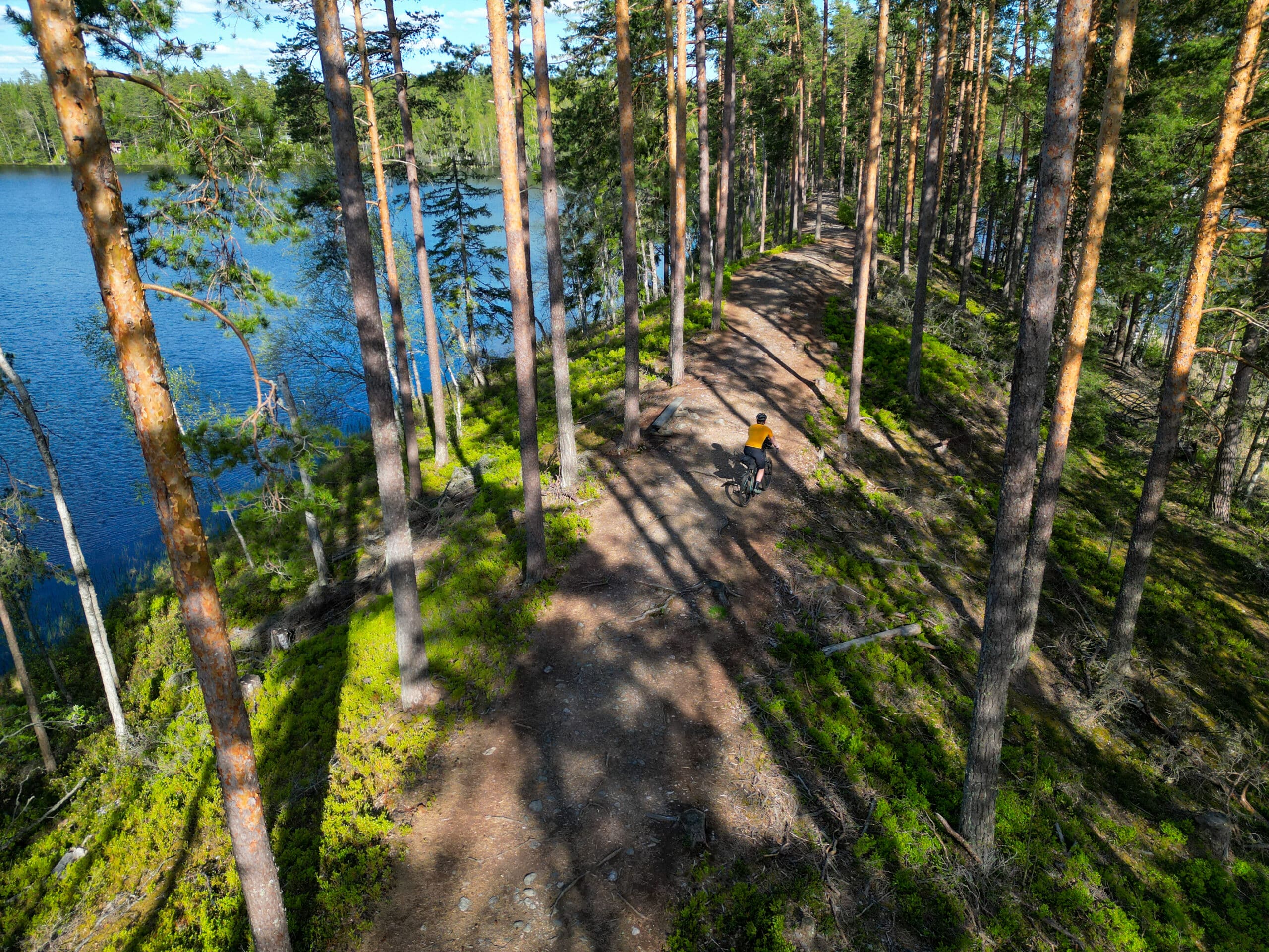
The ride through Komio takes you along scenic sandy roads through pine forests and ridges. After Komio, the terrain towards Räyskälä is known as “rollercoaster roads”: first the gravelled Eräläntie, then the paved Räyskäläntie. Both demand steady handling and are best enjoyed at an easy pace.
Before reaching Räyskälä, you can make a 2 km detour to Marskin Maja. In summer, its café and museum offer a memorable stop. Other possible day-break spots along the way are Pilkuttimen kota and Sähkönokka (note: no overnight camping allowed here).
At around 70 km you’ll arrive at Räyskälä village shop, the last chance to resupply before Tammela. Nearby you’ll also find the Räyskälä airfield restaurant and Camping Laakasalo, where camping with a tent is possible.
Räyskälä – Saaren Kansanpuisto – Tammela – Forssa (51 km total)
Hämeen Lake Uplands & Melkuttimen Road
From Räyskälä, the route turns onto Härkätie leading into the Hämeen Lake Uplands. This area has stunning lake and ridge landscapes – a perfect stretch to enjoy open views and forested scenery.
Porras & Saaren Kansanpuisto
Continuing along rolling gravel roads, the trail connects with Hämeen Härkätie before reaching Portaan village. Porta has historically been an important crossroads during the heyday of Hämeen Härkätie. Here you can stop at Portaan Nahkurinverstas for coffee, a snack, or to explore the unique tanned leather factory museum.
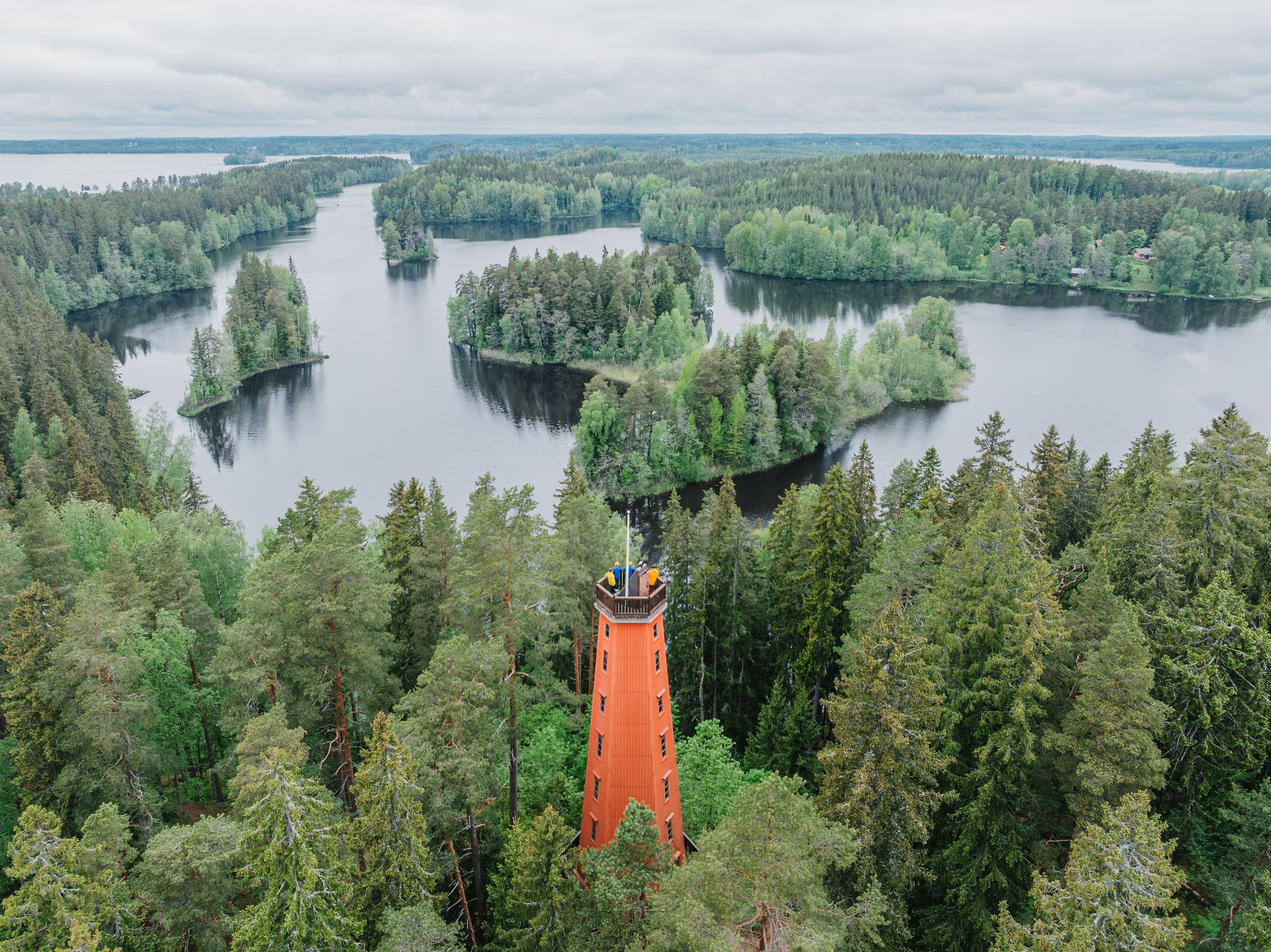
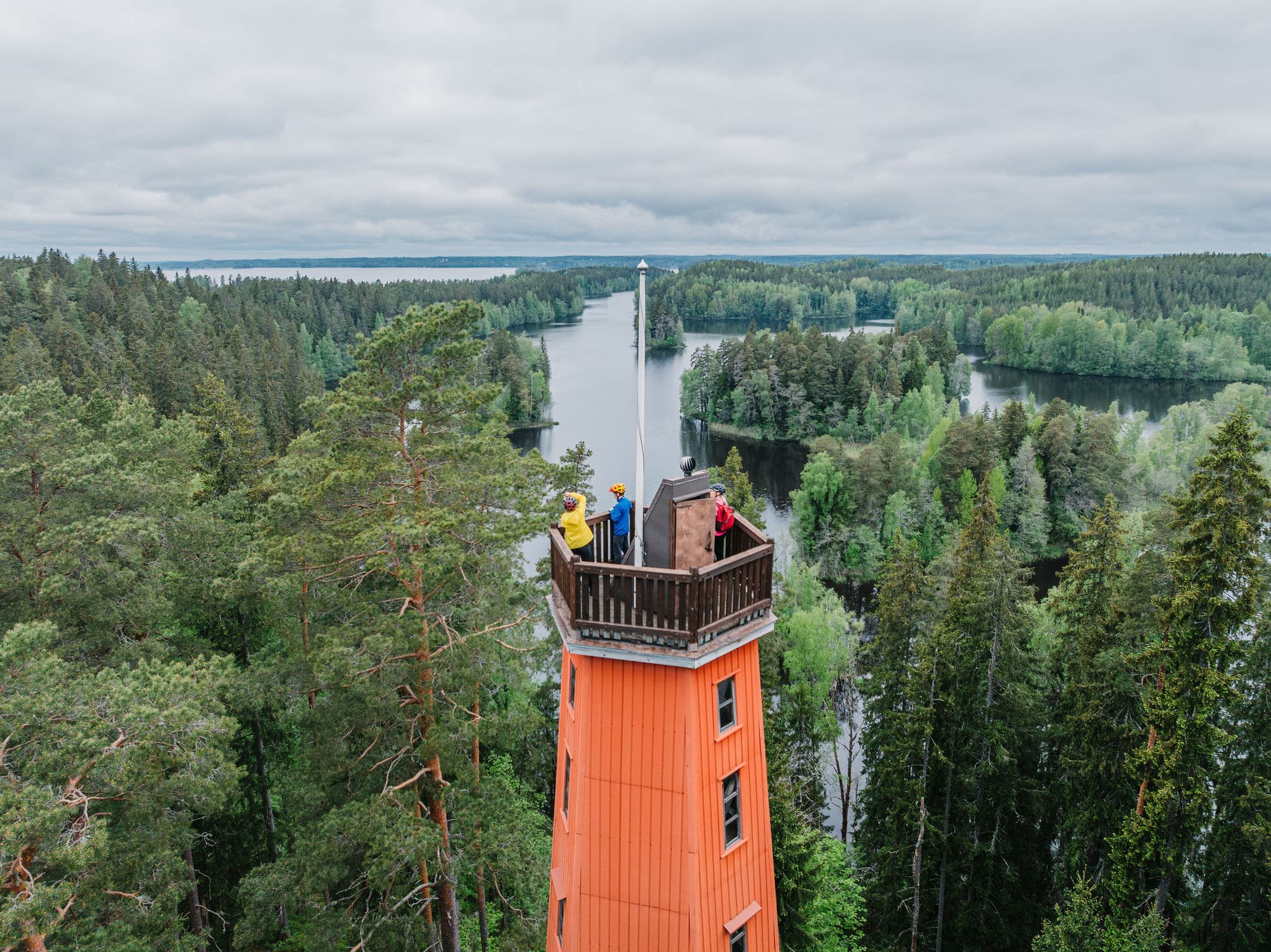
A short paved section then leads into one of the most scenic parts of the route: Saaren Kansanpuisto. This park features lush woodland trails, a restaurant, kiosks, beaches, and historical sites. Overnight camping is allowed only at the Raanpää lean-tos by Kuivajärvi. Nearby, Venesilta camping offers cabins and tent sites with additional services. Before leaving the park towards Tammela, take the opportunity to visit Kaukolanharju observation tower and the Albert Edelfelt memorial.
Saaren Kansanpuisto – Tammela (15 km)
Exiting the park, cross the old concrete Saarensalmi bridge, then follow bike path signs towards Suvikuja. After climbing Kukkuramäki, you continue along cycle paths to Tammela village. Tammela is a good place to refill food and drinks before the next section.
Tammela – Forssa
From Tammela, the route heads along the old church road via Syrjänharju, which includes some technical trail sections with small rocks – a short section may require walking the bike. The stage finishes at Forssa bus station, where you’ll find a market square, shops, and restaurants – a convenient end to the first part of the journey.
Forssa – Pääjärvi – Hämeenlinna (99 km)
Forssa – Häme Ox Road & Pääjärvi Recreation Area
Leaving Forssa bus station, the trail heads towards the Häme Ox Road, offering a historical journey reminiscent of the Viking Age. Before leaving Forssa, make sure you have enough water and food, as the next larger shop is over 60 km away.
The route passes Linikkalanlammi beach, a perfect spot to refresh early in the stage. Continuing along small gravel roads, you reach Mustiala Manor, a historic stop where you can enjoy the scenic surroundings and visit the rural museum.
From there, the trail leads to Pääjärvi Nature Recreation Area. East of Kuivajärvi, accommodation is available at Hykkilä cottages. The gravel road then turns into a forest track, climbing the steep Uudensillanmäki – ride carefully according to your skill level. At Pääjärvi, you’ll find swimming spots, lean-tos, and opportunities for overnight camping – a great place to enjoy a break before continuing.
Pääjärvi – Renko
After leaving Pääjärvi, the route returns briefly to Hämeen Härkäti before following the forest track-style Rauniotie to Pitkäjärvi farm. The ascent to the farm is steep and slippery when wet. The farm provides a scenic rest stop before heading to Nummenkylä village hall, which offers a café and beach.
Following rolling gravel roads, the trail reaches Rengon village. Here you can refill drinks and energy, visit the Häme Oxroad Museum, or use the rental lean-to at Kulttila village association.
From Renko to Hämeenlinna
Leaving Renko, the trail continues along varied gravel roads. Services are sparse, so carry sufficient food and water. approximately 30 km away.
The trail rejoins Häme Ox Road, climbing the ridge at Ahvenisto. This section includes a short technical path where walking the bike may be necessary. The route continues through Punaportti and along Lake Vanaja to Hämeenlinna railway station.
Arrival in Hämeenlinna
Before the endpoint, consider a stop at Hämeenlinna Market Square for a café break. The city also offers Häme Castle, Finland’s largest Prison museum, and Museum Militaria. After reaching Lake Vanajavesi, you can refresh at the swimming hall or beach. Overnight accommodation is available at the hotels in Hämeenlinna.
Hämeenlinna – Kiipula – Riihimäki (52 km)
Hämeenlinna – Lake Katumajärvi & Vanajanlinna
The third stage starts at Hämeenlinna railway station. The trail leaves the city via the local bike network, passing through suburban areas along the railway. About 3 km south of the station, you can visit the Kantola mural, a large and expressive public artwork – a local landmark and cultural highlight.
The route continues toward Katumajärvi, where the Honkalan ranta nature reserve offers beautiful views and a birdwatching tower. The trail skirts Vanaja Golf park and reaches Hotelli Vanajanlinna, a historic castle with surrounding scenic areas for a relaxing break. From there, the trail continues along a smooth torppari asphalt section to Harviala Manor, where a café provides a refreshing pause.
Turenki – Kiipula
The route then follows a gentle downhill gravel road alongside the railway to Tureng, passing Liinalampi, a swimming spot perfect for hot summer days. In Turenki, you can refill supplies in local shops or enjoy a meal at a restaurant.
From Turenki, the trail follows the short Kustaa Paturi park trail and a recreational path to Kiipula. Kiipula is a diverse stop offering accommodation and a wide range of activities, including Eläinpiha, frisbee golf, fitness stairs, trail running, hiking, and marked mountain bike trails. Rental options include Kiipula lean-to and Jussin laavu (firewood not provided). The Kiipula Vocational College facilities make it an excellent spot for a longer rest.
Kiipula – Riihimäki
From Kiipula, the trail follows gravel roads to Leppäkoski, where the seasonal pancake café is a great place for a snack. Cross the Puujoen bridge, with its fragrant tar scent, a perfect photo spot.
Continuing toward Ryttylä through rural landscapes, the route briefly uses paved village roads before turning onto the gravel shortcut to Kolmilammi. This area, embraced by ridges, features a traditional dance pavilion. Here you can enjoy a brief break or a short swim in the ponds. In the evening, looking north from the fields at Salpausselkä ridge offers a fantastic view – a perfect selfie moment.
The trail then continues through scenic farmland toward Riihimäki, following open gravel roads. Passing a local berry farm, you reach Highway 54, which requires careful crossing. The final short gravel section leads into the urban area and back to Riihimäki railway station, completing the circular route.
Explore other Häme by Cycle Routes
-
 35 km
35 kmEvo Green Gold Gravel Loop
Evo Green Gold Gravel LoopRide through one of Southern Finland’s largest continuous forest areas, where old-growth woods, quiet lakes, and untouched wilderness create a true back-to-nature experience.
-
 140 km
Odin’s Journey
Odin's JourneyExplore the countryside along historic trade routes, with gentle climbs, fields, and forests. Sustainable travel meets history through Torronsuo and Liesjärvi National Parks.
-
 12 km
12 kmTiny Sisu’s Family Tour
Tiny Sisu'sFinland’s first family-friendly bike touring route invites young adventurers to explore cultural landscapes and ancient artifacts from Iron Age. Perfect for short and fun rides with children.
-
 264 km
Hulder’s Journey
Hulder's JourneyRide deep into forest trails, shimmering lakes, and quiet gravel roads that echo Nordic folklore. The Hulder’s Journey is a multi-day adventure where nature’s hidden spirit leads the way.
-
 560 km
Viking’s Route
Viikingin kierrosA gravel and bikepacking adventure through Häme, where quiet forests, sparkling lakes, and centuries-old trade paths meet peaceful national parks. Ride a mix of gravel, forest roads, and smooth asphalt on a journey that blends historical landscapes and nature into gravel adventures.
The Häme by Cycle routes have been created through the Häme by Cycle – Developing Cycle Tourism in Kanta-Häme project by LAB University of Applied Sciences and the Häme Nature Recreation Association. The project has been funded by the European Agricultural Fund for Rural Development for the 2023–2027 programme period.
![]()