Häme by Cycle: Tiny Sisu’s
Family Friendly Cycling Route in Southern Finland
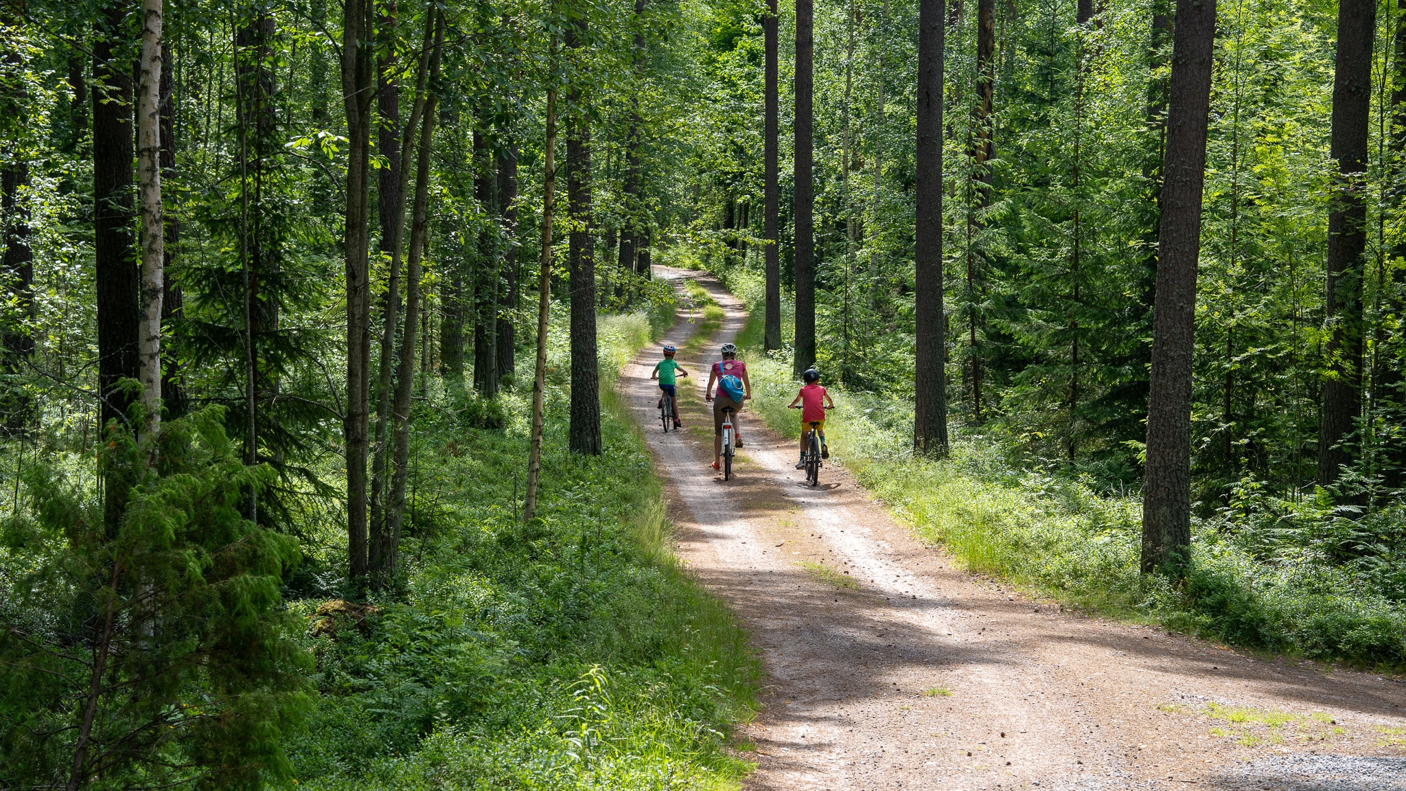
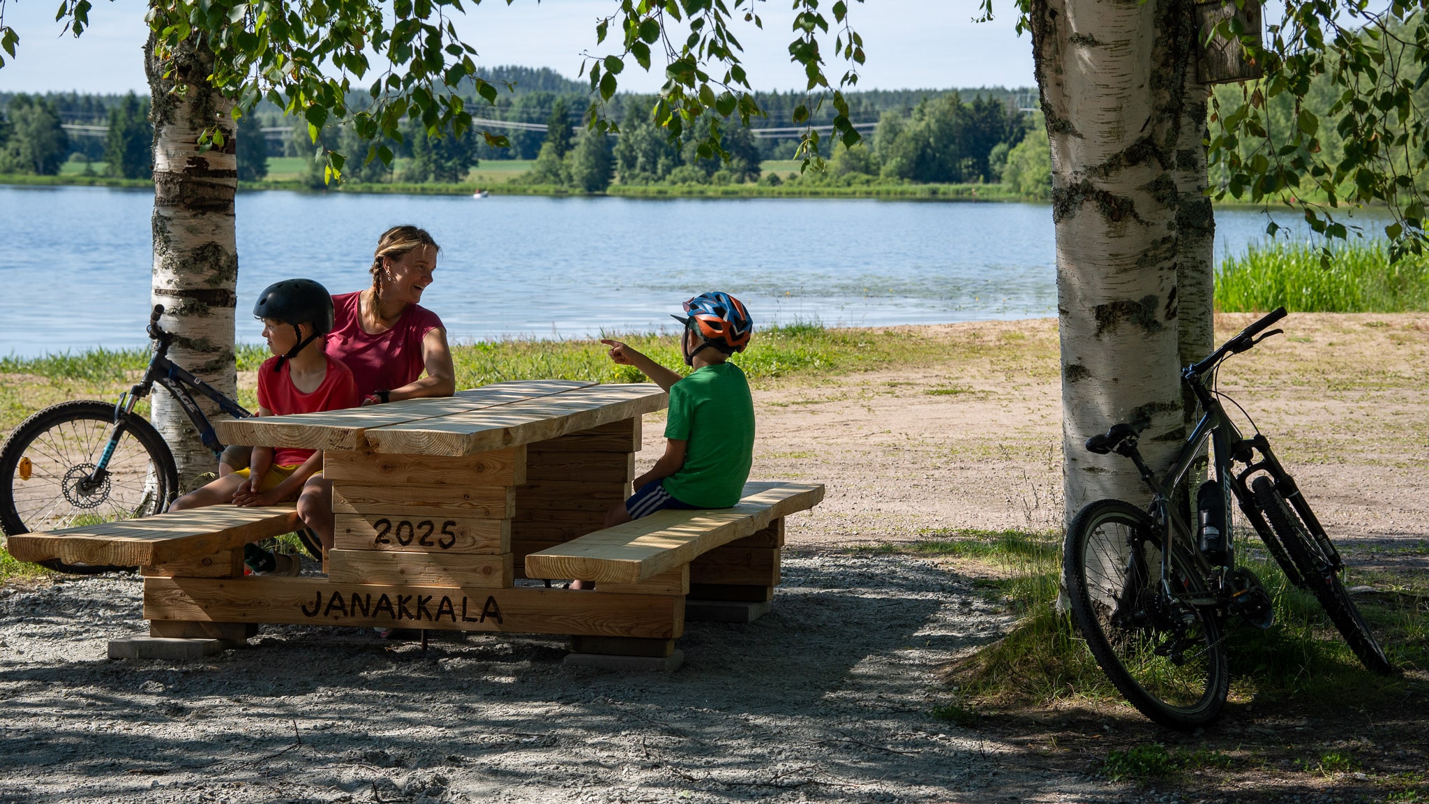
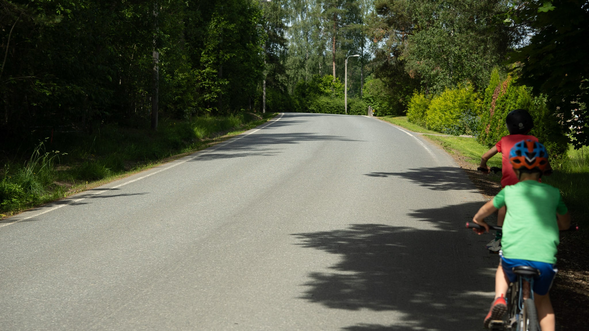
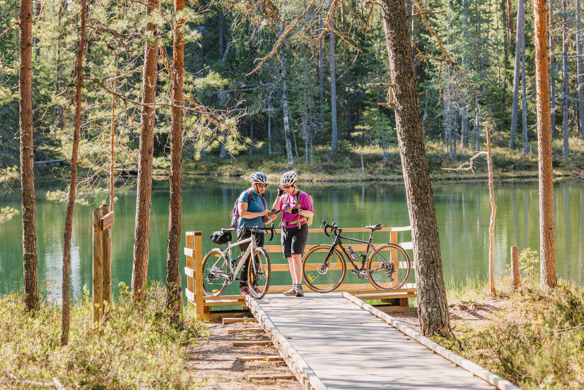
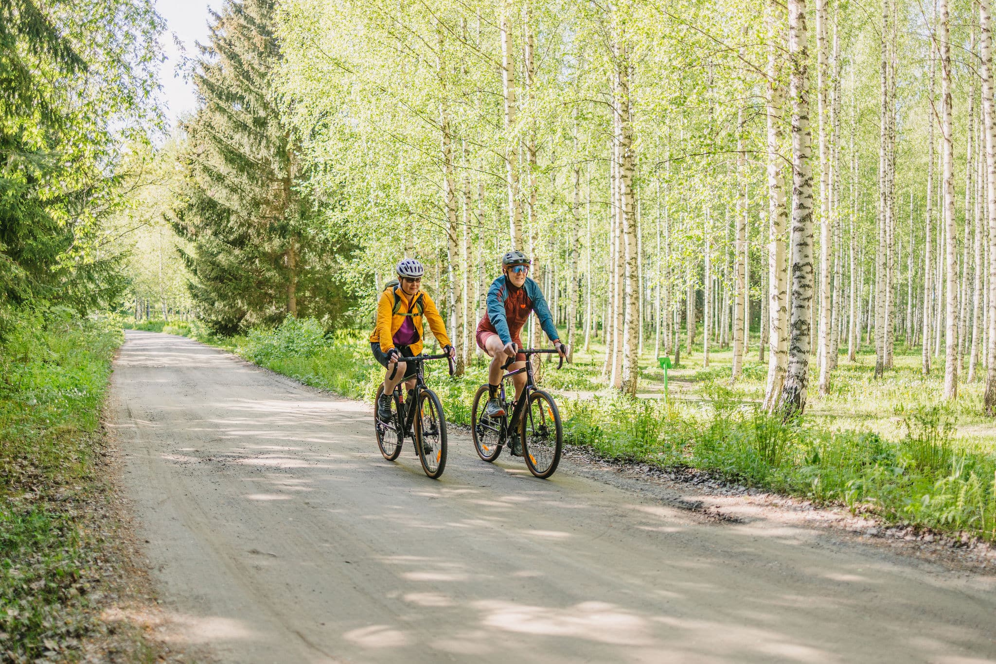
Tiny Sisu’s Family Tour is an easy 12.5 km cycling route through rural landscapes to Laurinmäki’s nature and cultural area. The tour mainly follows paved cycle paths, and it is ideal for families, beginner cyclists, seniors, and those who enjoy slow tourism. The route is easily accessible by train, and the swimming beaches, cafés, and restaurants along the way make this day out a pleasant, easy experience.
At the end of Tiny Sisu’s Tour, it’s worth getting off the bike to explore Laurinmäki’s nature and cultural area which tells stories from the Iron Age to the present day and surrounds you with the best nature Häme has to offer.
Distance
12 km
Duration
2-4 hours
Total ascent
78 m
Highest point
123 m
Unpaved
17 %
Singletrack
109 m
Difficulty (1-6)
1
Rideable
100 %
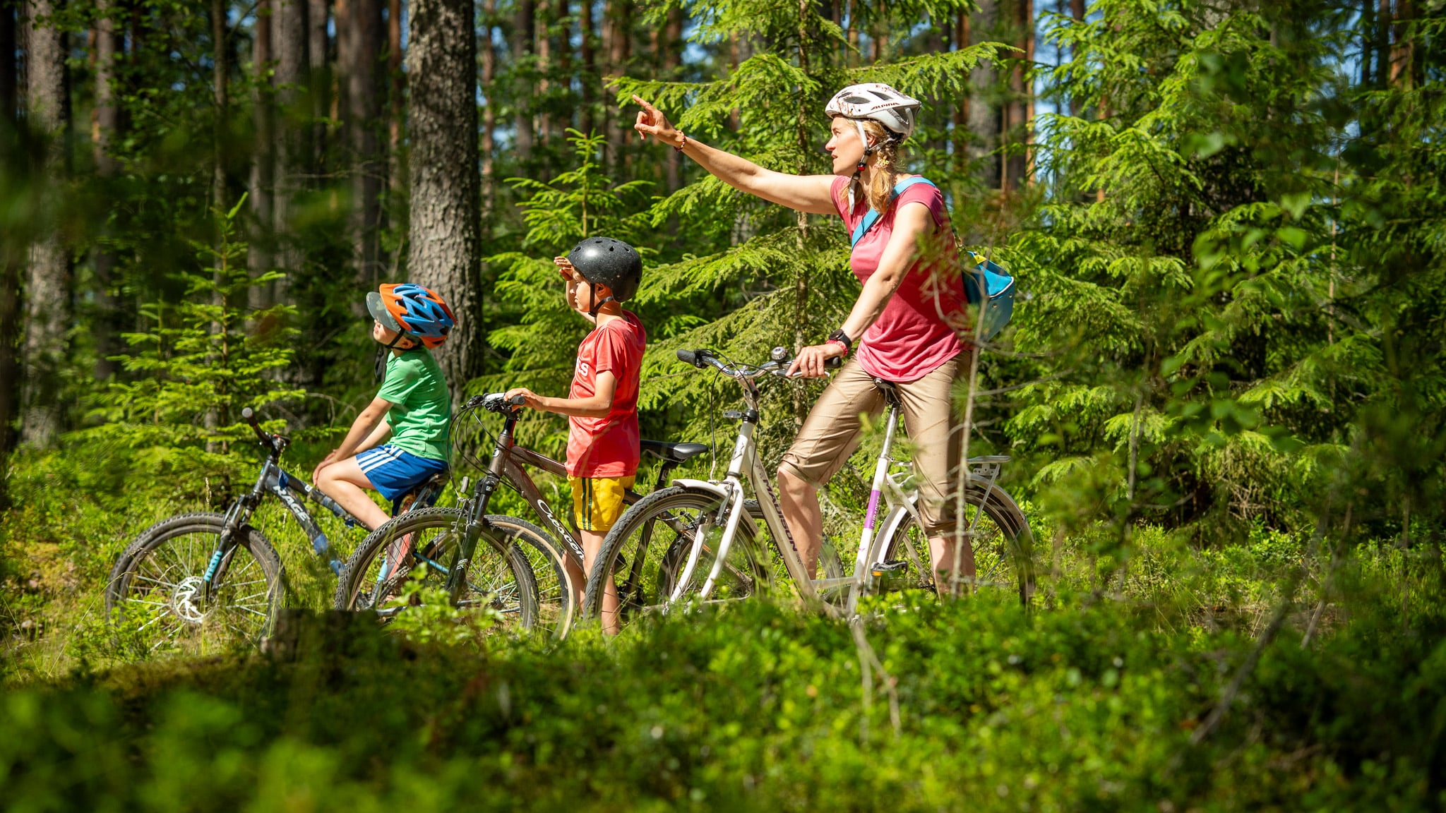
A cycling adventure for the whole family
Combining the history of the Kanta-Häme region, varied nature, and comfortable rest stops, this 12 km route offers an exciting day out for cyclists of all ages and levels.
Turenki’s restaurants and cafés make it easy to keep the whole party refuelled without taking a packed lunch with you. The small town centre services are within easy reach, and you can reward little cyclists at the local ice-cream kiosk. Accommodation is available in Turenki or Kiipula.
Cycling through nature, history and shared moments
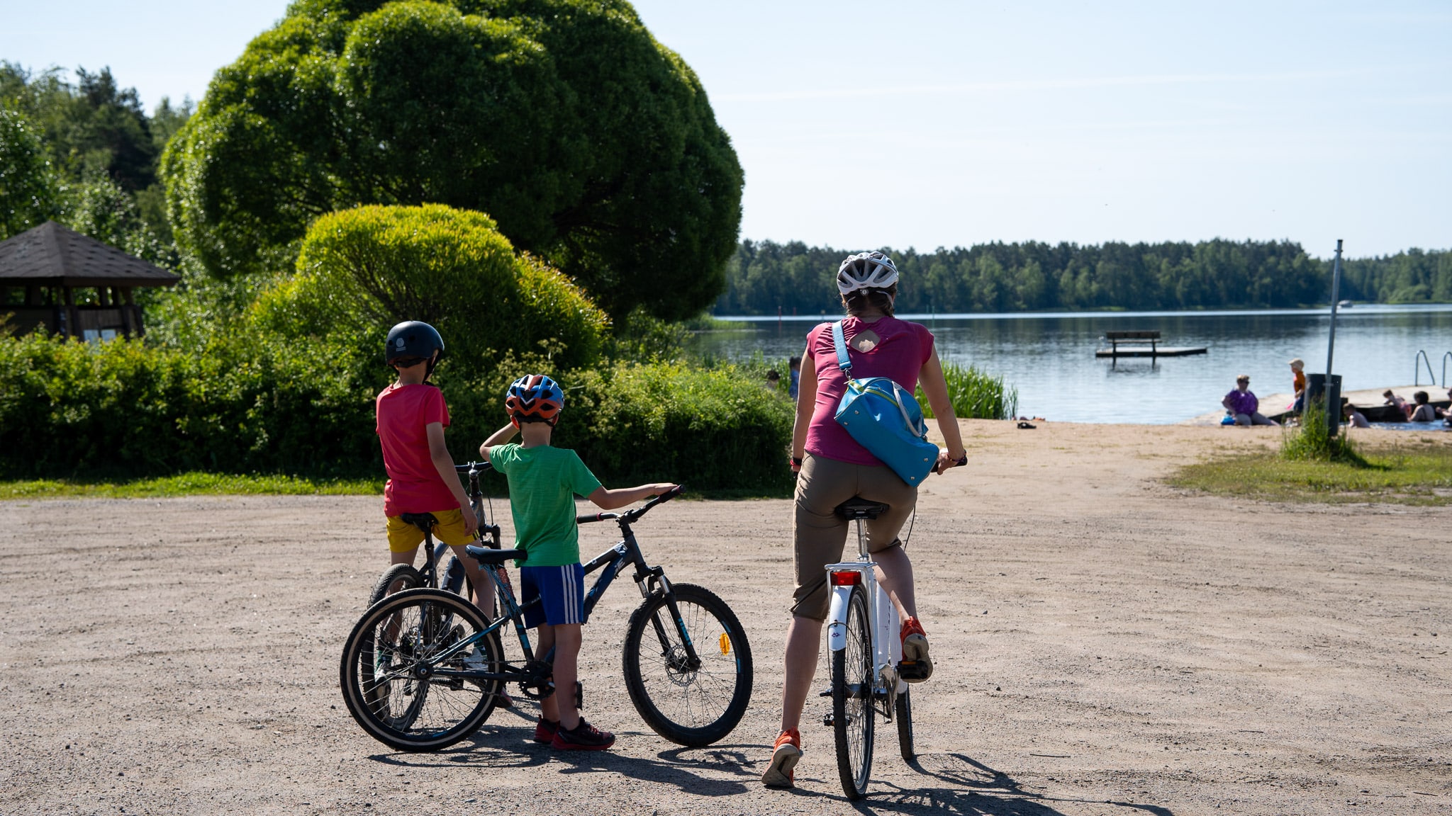
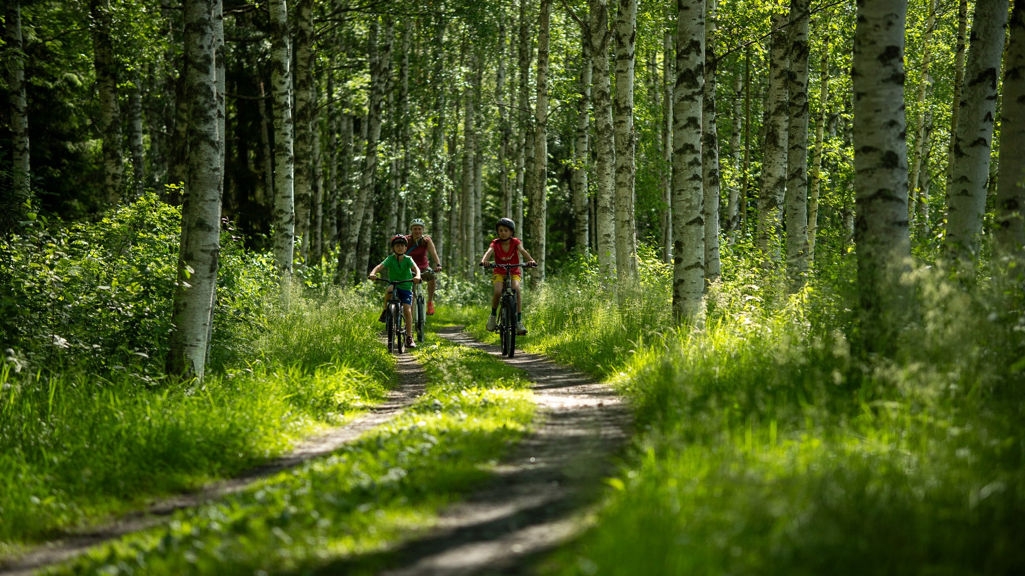
The route starts at Turenki railway station, which is easy to reach by train from all over Southern Finland. Right at the start, you can take a dip in the lake and continue along the birch-lined road along Hiidenjoki River.
Along the way, the scenery varies from forest strips to wide open fields, and halfway along the route you reach Laurinmäki’s nature and cultural area – a historical highlight of the trip.
Route information
The route is at its best from June to August, when the summer cafés are open.
It is designed to be enjoyed at a relaxed pace as a one-day tour. The route can be shortened by 1.7 kilometres by skipping the gravel section in Janakkala’s church village.
Accommodation is available in Janakkala, and motorhome travellers can stay overnight at the Janakkala motorhome park. Close to Turenki, Kiipula offers a range of services including a petting zoo, activity park and accommodation – making it easy to extend your stay and enjoy an active holiday surrounded by nature.
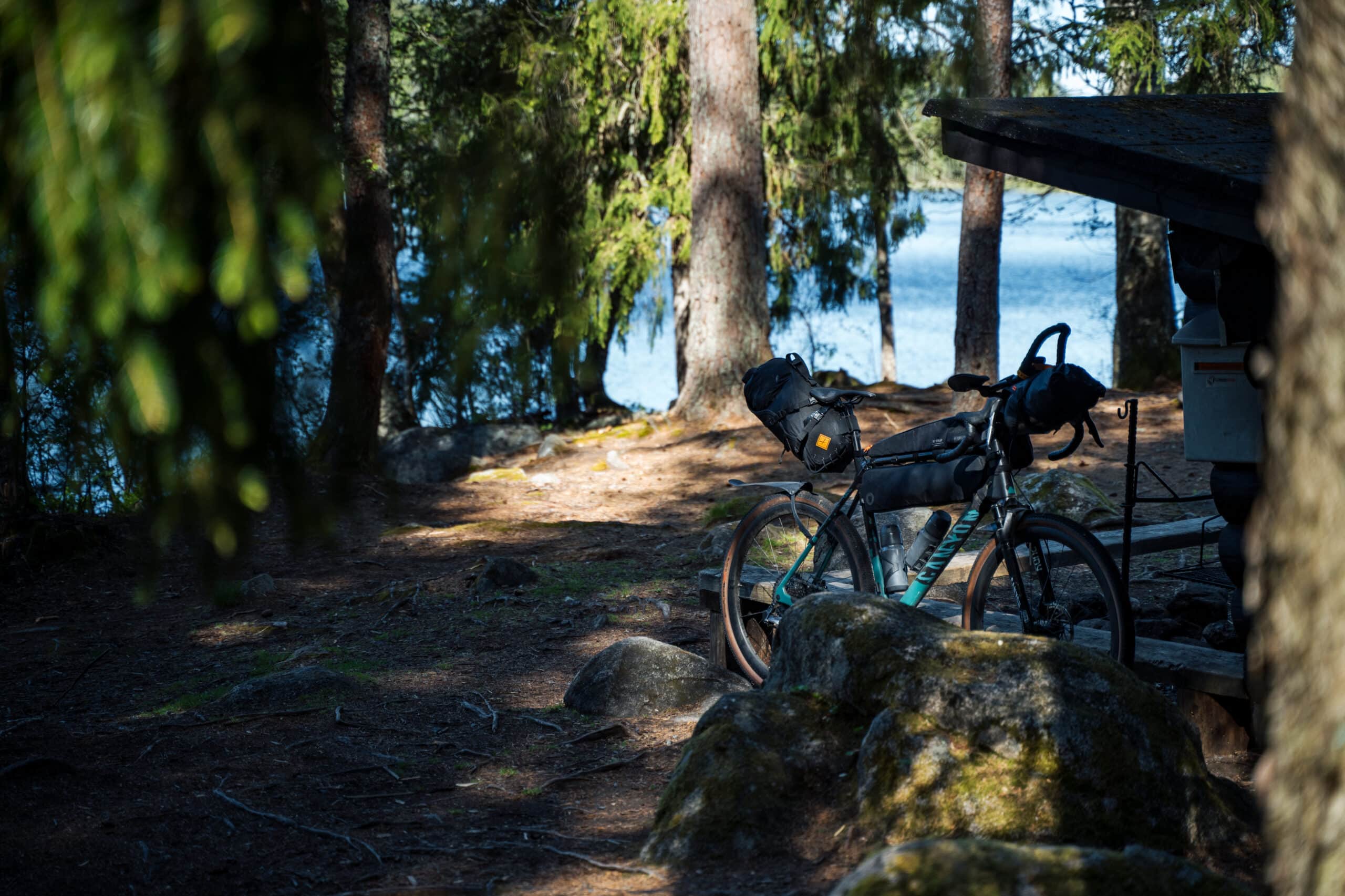
The route is suitable for touring, gravel and mountain bikes.
A detailed route description can be found at the bottom of this page.
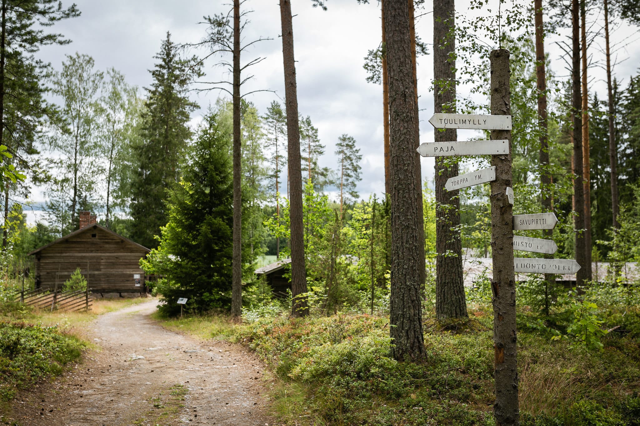
Immerse yourself in Häme’s nature and cultural history at Laurinmäki
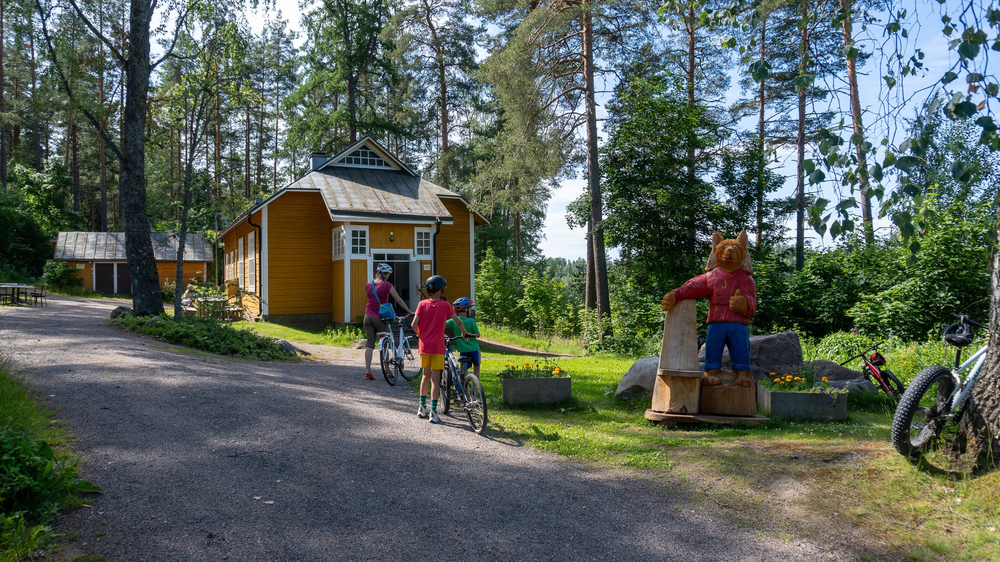
The Laurinmäki Nature and Cultural Area in Janakkala’s church village is a true treasure, inviting the whole family to explore the past and enjoy the peace of the forest. The tenant farm museum brings late 19th-century life vividly to life – step inside a smoke cabin, visit the blacksmith’s workshop or peek into the sauna elf’s hiding place.
Along the marked nature trails, you’ll find campfire sites and unique relics such as Iron Age sacrificial stones, a sacred grove and St. Lawrence’s spring. The longest trail leads up to the rocky hills of Määkynmäki, where sweeping views open towards Lake Kernaala and the ancient hillfort of Hakoinen.
At the trailhead, the charming Yellow House awaits – once a prayer room, now a summer café. It’s a cosy stop for both hikers on a snack break and visitors drawn by the area’s rich cultural heritage.
Highlights
- Easy family-friendly route
- Laurinmäki nature and cultural area
- Medieval stone church of St. Lawrence
- Marked nature trails in Laurinmäki (walking only)
- Child-friendly swimming spots along the route
- The asphalt section can be ridden on a dedicated cycling and pedestrian path
- Finland’s oldest preserved wooden railway station
Good to know
- The route can be cycled in three seasons – spring, summer and autumn. It is at its very best from June until mid-August, when the summer cafés are open.
- Any well-maintained touring, gravel, or mountain bike is suitable.
- Navigation is provided only digitally. Read Bikeland.fi’s instructions and tips for successful route navigation.
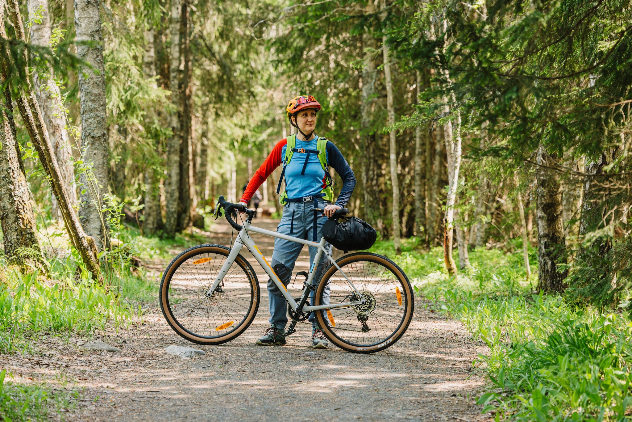
- Along the route, there are several points of interest that can only be explored on foot. When visiting these sites, it’s recommended to bring suitable walking shoes and a lock for securing your bike.
- A campfire site is available at the Ahilammi kota shelter, where a small amount of firewood can be purchased.
- Please note that the route is guided only by digital navigation – see bikeland.fi for instructions and tips to ensure a smooth cycling experience.
- Always stay on the marked route and use only the recommended campsites and rest areas listed in the route description.
- Respect the fragile nature and rural surroundings — never leave litter behind.
Follow the general Outdoor Etiquette and the Mountain Biking Etiquette, and show respect for farm machinery by waiting until it has cleared the road before continuing. - There are fire pits along the route, but wood supply varies. Fires are allowed only in designated places, and open fires are strictly prohibited during wildfire warnings. Information on local fire warnings can be found on the Finnish Meteorological Institute’s website.
- Check the weather forecast before setting out and bring gear suitable for the conditions. Always inform someone of your plans and estimated arrival time before you start your ride.
- Mobile network coverage is good throughout most of the route. If the 112 app does not work, call the emergency number 112 directly. Always use the 112 app when possible, as it automatically provides your location.
- The route runs not only on public roads but also on private roads maintained by local road associations. If you encounter poorly maintained sections, please inform us at info@hvay.fi so we can update the route condition information and notify the responsible road association.
Accommodation
- Accommodation near the route ranges from cosy cottages to floating river cabins. See the list of options at the bottom of this page. We recommend booking in advance and checking the availability of secure bike storage.
- There are no designated camping areas along the route. Please familiarise yourself with Finnish outdoor etiquette, and note that most of Laurinmäki is a protected nature reserve.
- For motorhome travellers, camping is permitted at the Turenki motorhome park.
Food & drink
-
Directly along the route, you’ll find a restaurant and a café open during the summer season. In Turenki town centre, just a short distance from the trail, there are additional cafés and restaurants.
-
Opening hours may vary by season, but summer cafés are most reliably open from Midsummer until early August. Be sure to check current opening times before your trip.
-
It is recommended to pack some light snacks in case you get hungry along the way – and don’t forget to bring your own water bottle.
Difficulty
The route is mostly easy to ride, following paved cycling paths and some gravel roads. The gravel sections can be bypassed if needed. Most of the route runs on a dedicated cycling and pedestrian path and can be ridden in either direction.
There are two road crossings without pedestrian crossings, both of which can be avoided by skipping the gravel section in Janakkala’s church village. The climbs are gentle – only 78 metres of total ascent – giving the route a difficulty rating of 1. You can find the difficulty classification table on bikeland.fi.
⚠️ Please take care when crossing or riding along roads:
- The shoulder of Santasillantie is followed for 200 metres.
- There are no pedestrian crossings at the intersections of Santasillantie / Vahvarannantie and Vahvarannantie / Rantalahdentie.
On Vahvarannantie and Rantalahdentie, you’ll be riding on gravel roads where cars may occasionally pass.
Arrival
Excellent public transport connections make the trail easily accessible for cyclists from all over Finland. There are four railway stations along the route.
By Train
Excellent rail connections make Turenki a convenient starting point for cyclists arriving from all over southern Finland. Turenki railway station is located on the Riihimäki–Hämeenlinna–Tampere line, and on local trains you can take your bike free of charge without a reservation.
On long-distance trains, bike transport requires a paid reservation – especially in summer and on weekends, seats should be booked well in advance. The nearest long-distance train stops are in Riihimäki and Hämeenlinna.
Check current timetables: 👉 vr.fi
By Car
For those arriving by car, Turenki’s park-and-ride at the corner of Taimistotie and Kauppakuja offers a convenient option, with both EV charging stations and engine heating outlets available.
Additional parking spaces can be found at Turenki bus station.
The municipality of Janakkala provides free parking where indicated by traffic signs—please follow local instructions. Disabled parking is available with a valid permit.
More information on parking: 👉 Janakkala municipality website
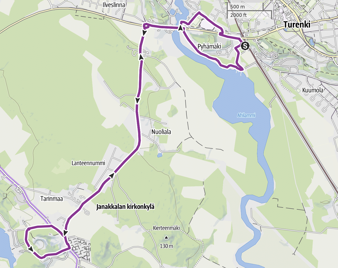
Route description
Starting point: Turenki Railway Station
Address: Asematie, 14200 Turenki
The route begins at the historic Turenki Railway Station, home to Finland’s oldest preserved wooden railway station building. The station building now houses the restaurant Turengin Wanha Asema. Before setting off, make sure you have snacks and drinks with you. In summer, these can be purchased from the station café or nearby shops and kiosks.
Three swimming beaches along the route
The first section of the route follows a paved road and soon turns onto a smooth gravel road towards Ahilammi beach and harbor. Here you’ll find the first of three sandy swimming spots along the route. From the harbor, continue along the Hiidenjoki riverbank through a beautiful birch grove on a gravel road. In spring and after heavy rain, there may be wet and soft spots on the path. The path leads to a paved road. There is no pedestrian crossing at the crossing point, and the paved road continues as a gentle uphill slope towards the Hiidenjoki bridge.
Cross Turengintie at the pedestrian crossing, turn left and cross the Hiidenjoki River, which flows between Lake Kernaalanjärvi and Hämeenlinna. After the bridge, there’s a gentle 300-meter uphill climb – the first challenge for Tiny Sisus. The route continues across a pedestrian crossing towards Tarinmaa, where rural landscapes begin. At this point, the route also rises gently, reaching its highest point (123 m), after which it descends gradually.
Lystinmäki takes you down and up
If uphills are challenging for you, you can shortcut this loop (1.7 km) by cycling along Hakoistenintie directly towards the church parking area.
Upon reaching the village, turn right and cycle 200 meters along the shoulder of Santasillantie on a paved road. From Santasillantie, the route turns onto gravel-based Vahvarannanntie, which has loose gravel in places. There is no pedestrian crossing at the intersection, so this section should be navigated with extra caution.
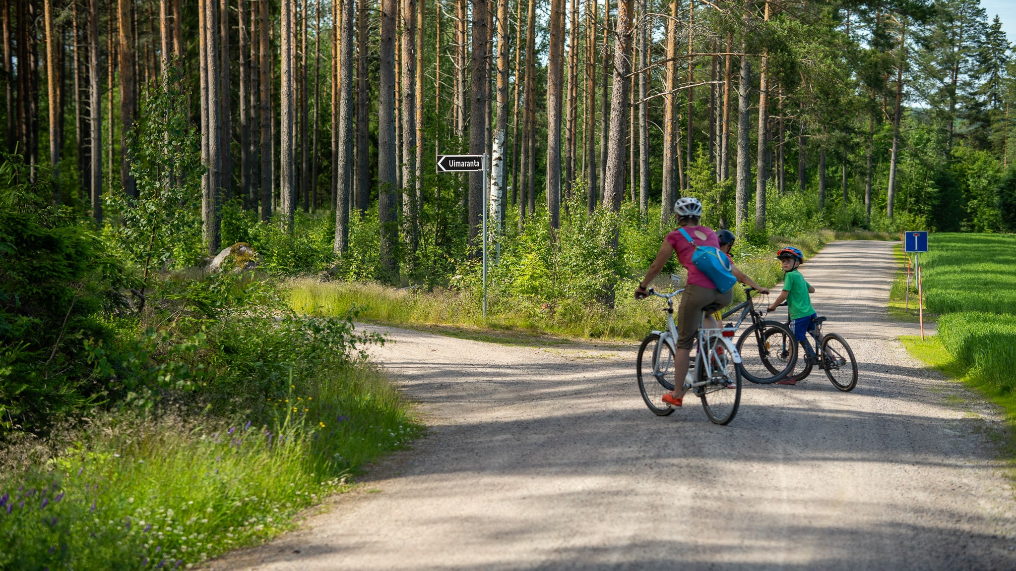
Follow Vahvarannanntie for 300 meters, then turn left towards the Uimaranta (Beach) sign. Here begins a smooth gravel road that descends downhill towards Pappilanranta beach.
After a refreshing swim, hop back on your bike and the road continues as a long climb (500m) past Lystinmäki towards St. Laurentius Church.
Laurinmäki – a charming nature and cultural area
The highlight of the route is the Laurinmäki nature and cultural area, which combines history and nature in a unique way. Nature trails wind through exceptionally diverse and beautiful scenery, with information boards along the way telling about the environment and its history. The trails are marked with white-painted sticks and pine cone symbols. Along the nature trail, you’ll find a wilderness shelter that makes an excellent rest and picnic spot.
If culture and history interest you more than nature trails, Laurinmäki offers plenty of fascinating sights and experiences within a shorter distance:
- Iron Age findings and cup stones
- Laurinlähde spring
- World War I trenches
- Crofter museum showcasing 19th-century crofter life
- Sacred grove and cremation cemetery
- Nature trails 1.6–2.8 km
- St. Laurentius Church
From Laurinmäki, the journey continues back to the paved road, and after about 300 meters, you’ll reach Janakkala’s St. Laurentius Church. This medieval stone church dating from the 1500s is one of Häme’s historical gems. The church is open to visitors during summer, and its spacious surroundings make for a charming stop.
👉🏼 Check the opening hours of Janakkala St. Laurentius Church (in Finnish)
Return journey towards Turenki
Liinalammi – a playful swimming spot for the whole family
It’s time to return to the present day along the Hakoistentie cycling path. On the return journey, towards the end of the route, turn left after the Hiidenjoki bridge. The gravel road slopes downward and leads to a narrow path where younger family members should cycle carefully along this narrow and short approximately 10-meter section. From the path, you’ll reach a gravel road and climb gently up a hill, then turn right to the Liinalammi recreation area. Here you’ll find a swimming spot with diving towers where you can refresh yourself on warm days. Liinalammi beach is popular among locals and is well-suited for families.
Return to Turenki Station
The final section of the route follows a paved cycling path back to Turenki Railway Station. At the end of Liinalammintie, there’s a 100-meter section without a cycling path. By following the left edge of the road, you can safely return to the cycling path. Before heading home, you can enjoy Turenki’s services near the station, such as restaurants, shops, or refresh yourself at Ahilammi beach, which was at the start of the route.
End point: Turenki Railway Station
NOTE! The platforms at Turenki Railway Station are on different sides of the railway track.
Accommodation in Janakkala
-

Tervakosken Tervaniemi Cabin Village
Cozy cottage accommodation in a peaceful forest and lake…
Read more Tervakosken Tervaniemi Cabin Village -

Haapaniemi Cottages
Cottages are located about one hours drive (circa 100…
Read more Haapaniemi Cottages -
 Sustainable Travel Finland
Overnight Stay in Country Home Erkkilä, Tervakoski
Country home bed and breakfast accommodation for two in…
Read more Overnight Stay in Country Home Erkkilä, Tervakoski -

River Floating Cabins
Unique, floating accommodation on the Hiidenjoki river. Whether…
Read more River Floating Cabins -

Villa Springrock
VILLA SPRINGROCK is a unique multifunctional villa located in…
Read more Villa Springrock -
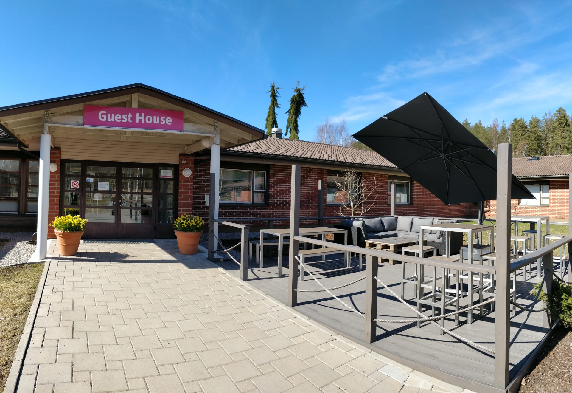
Kiipula Guest House
We offer diverse and accessible accommodation options for private…
Read more Kiipula Guest House
Explore other Häme by Cycle routes
-
 35 km
35 kmEvo Green Gold Gravel Loop
Evo Green Gold Gravel LoopRide through one of Southern Finland’s largest continuous forest areas, where old-growth woods, quiet lakes, and untouched wilderness create a true back-to-nature experience.
-
 260 km
East Strider’s Trail
East Strider's TrailCycle through the heart of Häme, from lively towns to tranquil ridges and farmland shaped by centuries of trade. The East Strider’s Trail is perfect for riders seeking variety, history, and wide-open horizons.
-
 264 km
Hulder’s Journey
Hulder's JourneyRide deep into forest trails, shimmering lakes, and quiet gravel roads that echo Nordic folklore. The Hulder’s Journey is a multi-day adventure where nature’s hidden spirit leads the way.
-
 140 km
Odin’s Journey
Odin's JourneyExplore the countryside along historic trade routes, with gentle climbs, fields, and forests. Sustainable travel meets history through Torronsuo and Liesjärvi National Parks.